Hail Damage to Solar Panels: What is Visible and What is Not?

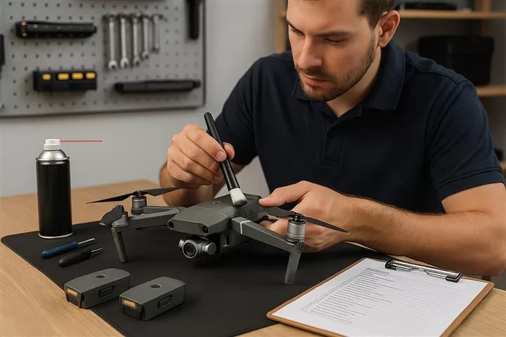
After a severe hailstorm, you might think your solar panels came through unscathed. The reality is different — by EASA-certified drone pilot Guy Liebert, Droneview.be

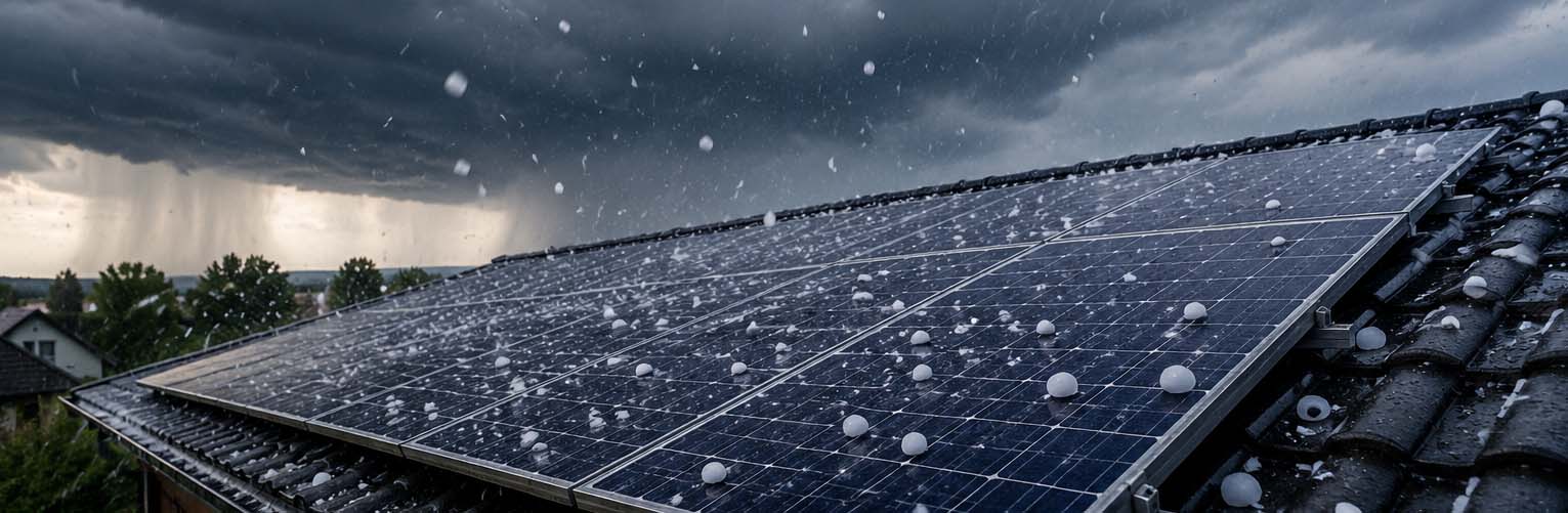
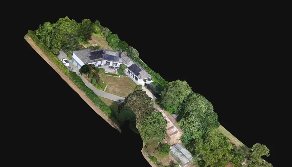
After the recent severe hailstorm in Belgium, we at Droneview.be immediately received a series of calls from owners and companies wanting their solar panels inspected. That is understandable — when you see glass shards on the roof or notice cracked panels, you know there is damage and want it documented as quickly as possible for the insurer.

That visible damage is one story. Broken glass, crushed cells, ripped-off junction boxes — it’s clear, you photograph it, you file it with the insurer. Done.

But the calls that concern us most are from owners who say: “Everything looks fine, no broken panels, but my inverter has been showing less than usual for two days.” Or worse: the owners who notice nothing at all — not yet.

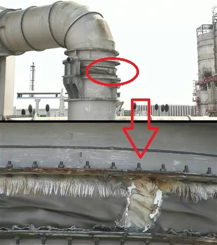
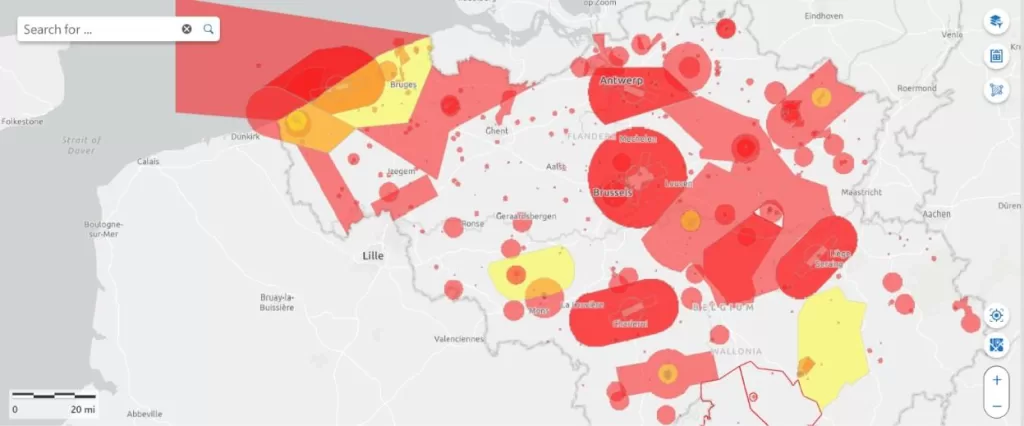
Hail damage to solar panels is 80% invisible to the naked eye — but very real and costly in the long term.

⏱ Recently affected by the hailstorm? Have your installation checked before filing an insurance claim — a professional thermal inspection report significantly strengthens your case. Request an urgent quote →

Continue reading “Hail Damage to Solar Panels: What is Visible and What is Not?”

Drone Survey in Belgium: What Can a Certified Drone Pilot Do For You?

Published by Guy Liebert, Droneview.be — EASA-certified drone pilot with 30 years of experience.

More and more contractors, property developers and government bodies are asking the same question: can a drone replace the traditional land surveyor? The answer is nuanced — but what is certain: a professional drone survey delivers measurement data faster, cheaper and safer than ever before.

In this article, I explain what drone surveying exactly entails, when you can benefit from it, and what the difference is with a certified land surveyor.


What is drone surveying?

Drone surveying — also called drone mapping, aerial survey or photogrammetric measurement — is the process of mapping a terrain, construction site or object using aerial photos taken by a drone.

The drone flies a systematic pattern over the area to be measured. The images have significant mutual overlap, allowing specialised software to calculate an accurate 2D orthoplan or 3D terrain model.

At Droneview.be, we use the DJI Matrice 30T — an industrial drone with RTK precision (Real-Time Kinematic GPS). This means centimetre-accurate positioning without ground personnel on site.

Continue reading “Drone Survey in Belgium: What Can a Certified Drone Pilot Do For You?”

Accurate Inventory of Bulk Materials with Drones

Do you truly know how much stock you have?

Many companies storing bulk materials—sand, gravel, ores, crushed stone, or waste streams—face the same challenge: the actual inventory is never quite certain. Traditional measurement methods are time-consuming, labor-intensive, and often inaccurate. The result? Uncertainty during audits, inefficient logistics, and potential financial risks.

Droneview.be offers a modern solution with professional drone technology and RTK precision.


Why traditional inventory falls short

With classic stockpile measurements, employees are deployed to climb heaps, take manual readings, or make estimates based on delivery notes. This entails three concrete problems:

  • Safety Risks: Climbing large stockpiles is dangerous and falls under preventive workplace safety concerns.
  • Time Loss: A full inventory of a large site can take days to complete.
  • Inaccuracy: Manual measurements or visual estimates can result in discrepancies of 5 to 15%—which has a significant financial impact on large volumes.

3D mapping of stockpile measurement with drone and Volume measurement of bulk materials via RTK drone

Continue reading “Accurate Inventory of Bulk Materials with Drones”

The 50% Savings Promise: How we deploy drones for the Belgian construction sector

Why a drone on-site is more than just a ‘flying camera’

In the Belgian construction and industrial sectors, drones are often cited as the ‘future’. At Droneview.be, we see that the future is already here. A recent analysis by Metamedia stated that industrial drones can reduce inspection costs by 50%. In our experience, that figure is actually quite conservative.

Anyone who thinks a drone is only for nice overview photos is missing the bigger picture. It’s not about the flight; it’s about the actionable data and the massive safety gains.

1. 50% savings? In practice, often much more

Take a concrete example: inspecting a membrane on a 70-meter high silo (see photo).

Drone inspection of a defective membrane on a silo at 70 meters height
Thanks to drone inspection, we map defects at great heights safely and rapidly without scaffolding.

For a technician, this is a complex, high-risk full-day task requiring scaffolding or cherry pickers.

With our drones, we can inspect dozens of silos in just a few hours, before a technician even leaves the ground. Our reports allow technicians to work efficiently, knowing exactly which part on which silo needs replacing. No wasted hours, no unnecessary risks. In this scenario, a 50% cost saving is an understatement.

2. CM-precise mapping: Data ready for immediate use

The true strength of Droneview.be lies in converting raw imagery into actionable intelligence. We use RTK (Real-Time Kinematic) drones paired with an RTK-3 base station. This allows us to collect geodata with centimeter-level precision.

Where surveyors used to spend days on-site, we now generate a full digital twin in a fraction of the time.

2D orthomosaic map of a construction site generated via drone photogrammetry
Detailed 2D mapping allows for cm-precise measurements directly in the browser.

The biggest advantage for our clients? Accessibility. Engineers and architects don’t need to invest in expensive software. We deliver data via a cloud environment (point cloud or orthomosaic), meaning they can perform volume measurements or ‘as-built’ comparisons directly in their browser.

Continue reading “The 50% Savings Promise: How we deploy drones for the Belgian construction sector”

From Site to Digital Twin: Our Professional Mapping Workflow

Creating a digital copy of a site seems simple: fly a drone and take photos. In practice, however, there is much more to it.

To create a terrain model that surveyors, site managers, and developers can truly rely on, an accurate and controlled process is required. At DroneView, we work with a professional mapping workflow where precision is key.

Step 1: Preparation and Mission Planning

Before heading to the site, the flight is digitally prepared. We analyze the airspace (especially in complex zones like Brussels) and program the optimal flight path. We determine the ideal overlap between photos to ensure a seamless 3D model later on.

Digital mission planning for drone mapping
The flight is pre-programmed for optimal overlap and full site coverage.

Step 2: Placing Ground Control Points (GCPs)

Continue reading “From Site to Digital Twin: Our Professional Mapping Workflow”

DJI M30T at Droneview.be: Compact Inspection Drone with Centimeter-Level Precision

With the deployment of the DJI Matrice 30T, Droneview.be strengthens its services in professional drone inspections, surveying support and data-driven site monitoring.

This drone is not a traditional upgrade, but an integrated measurement platform combining inspection, mapping, thermography and distance measurement in one robust system.

For construction projects, property developers and architects where every centimeter matters, this technology makes a measurable difference.

For complex projects where every centimeter counts, the M30T truly makes the difference.


Centimeter-level mapping accuracy thanks to our own RTK station and FLEPOS

The M30T features built-in RTK (Real-Time Kinematic). For maximum accuracy, Droneview.be operates with a professional in-house RTK base station, connected to the Belgian FLEPOS reference network.

This combination allows us to achieve positioning accuracy of 1 to 3 centimeters, fully compliant with surveying standards.

Using our own RTK station means:

Continue reading “DJI M30T at Droneview.be: Compact Inspection Drone with Centimeter-Level Precision”

From 3D House Scans to Construction Monitoring and Inspections

What Can You Do with WebODM?

At DroneView.be, we see every day how powerful drone imagery can be — not only for creating impressive photos, but especially for delivering practical insights. Thanks to WebODM, we can turn raw aerial photos into clear maps, 3D models, and measurable data. This opens the door to applications across many sectors: from real estate and construction to agriculture and technical inspections. In this article, you’ll discover how versatile drone mapping really is, and where you can use it.


3D Scans and Virtual Tours for Real Estate

Selling a property goes faster and easier when you present it visually in an attractive way. With WebODM we can:

  • create a 3D scan of a house or apartment
  • set up a virtual tour of a property so buyers can explore online
  • generate floor plans and measurements from aerial images

For real estate agents and developers this is a huge asset: it saves time, provides a clearer picture, and makes a property much more appealing online.

Keywords: 3D house scan, virtual home tour, selling property with drones

Interactive 3D view of a villa – example of a Real Estate 3D Scan by DroneView.be
Example of a 3D villa viewable online through our Real Estate 3D Scan service

Continue reading “From 3D House Scans to Construction Monitoring and Inspections”

Planning and requesting drone flights in Belgium: The Complete Guide

Flying a drone in Belgium is no longer a matter of “just taking off”. Whether you fly recreationally or carry out professional missions for inspections, construction sites or real estate, proper preparation is essential. Ignoring the rules can lead not only to fines, but also to your flight being stopped on site.

In this article, we explain step by step how to:

  • check whether you are allowed to fly at a specific location
  • determine whether an official request is required
  • correctly submit a flight via the Drone Service Application (DSA)
  • know what to do on the day of the flight

This article builds on our earlier explanation of GeoZones and drone legislation in Belgium.

That basic knowledge remains important and can be read here:
https://www.droneview.be/en/stricter-drone-control-in-europe-how-to-check-where-you-can-fly-in-belgium/

Step 1: First check where you are allowed to fly – Droneguide

Every drone flight starts with one simple question: am I allowed to fly here?

The official map for this is the Droneguide map from skeyes.

Go to: https://map.droneguide.be

On this map, you can immediately see:

  • prohibited zones (no-fly zones)
  • warning zones
  • zones with specific conditions (such as around airports, industry, ports or military areas)

Zoom in on your planned location and click on the zone. You will immediately receive additional information about:

  • the type of GeoZone
  • who manages the zone
  • whether an authorisation is required

Important to remember:

The Droneguide map is an information tool.
It tells you whether flying is allowed, but it does not grant permission.

If you see that your location is in a GeoZone managed by skeyes (such as VLL zones around airports), a request via the DSA is mandatory.

Step 2: When do you need the DSA Planner?

Continue reading “Planning and requesting drone flights in Belgium: The Complete Guide”

The DJI M210: our trusted workhorse in the sky

It may not be the newest drone in DJI’s lineup, but the Matrice 210 continues to prove its worth. At DroneView.be, this robust drone remains a reliable choice for clients who demand precision, flexibility, and consistent performance in the air.

A drone that gets the job done
The DJI M210 is built for tough tasks. Whether it’s roof inspections, industrial sites, solar panels, or hard-to-reach infrastructure – this drone handles it all. It 
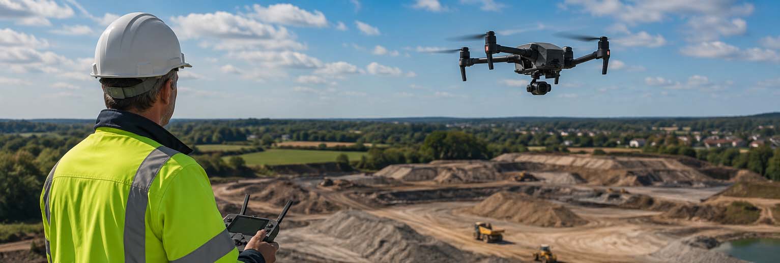
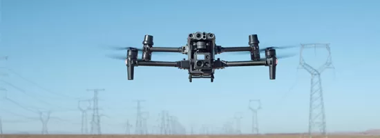
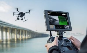
also performs well in challenging weather conditions: rain, wind, cold – the M210 keeps flying.

Modular and multifunctional

Continue reading “The DJI M210: our trusted workhorse in the sky”

Maintaining & Upgrading Drones: Our Experiences and Practical Tips

We are always focused on keeping our drones in top condition through maintenance and upgrades. In this article, we share how we maintain our drones and the tips we personally apply. At the end, you’ll find our handy maintenance checklist—hopefully, you’ll find value in the insights we share!

Our Basic Drone Maintenance Principles

Regular Inspections

Before every flight, we conduct a thorough visual inspection of our drones. We check for visible damage, loose components, and signs of wear. We also ensure that our sensors and cameras are clean, allowing us to achieve optimal performance at all times.

Battery Maintenance

We strictly follow the recommended charging cycles and avoid overcharging or completely draining our batteries. We also store them in a cool, dry place, which not only extends battery life but also ensures consistent flight performance.

Firmware and Software Updates

Keeping firmware and software up to date is a must for us. This ensures we benefit from the latest features, flight safety improvements, and bug fixes. We schedule updates and test them carefully before using our drones again.

Continue reading “Maintaining & Upgrading Drones: Our Experiences and Practical Tips”