
Search & Rescue Operations: Technical Drone Support
In missing person cases, every second counts. Droneview.be provides specialized technical support to emergency services and private search teams using advanced thermal and optical sensors.
At Droneview.be, we serve as a crucial aerial extension for emergency services during search and rescue (SAR) operations. Utilizing our DJI Matrice 30T, we can scan vast areas from the air that are difficult or dangerous for ground teams to access. Please note: we are not an investigative agency. We offer our services as technical support, providing high-quality aerial imagery and data to the official authorities on the ground.
Immediate Deployment & Expertise
Our EASA-certified pilot holds the necessary qualifications (Open A1/A3, A2 & Pro) to operate safely in complex scenarios. Thanks to the rapid setup time of the M30T, we can be operational within minutes of arrival anywhere in Belgium.
Powerful Sensors for Maximum Detection Chance
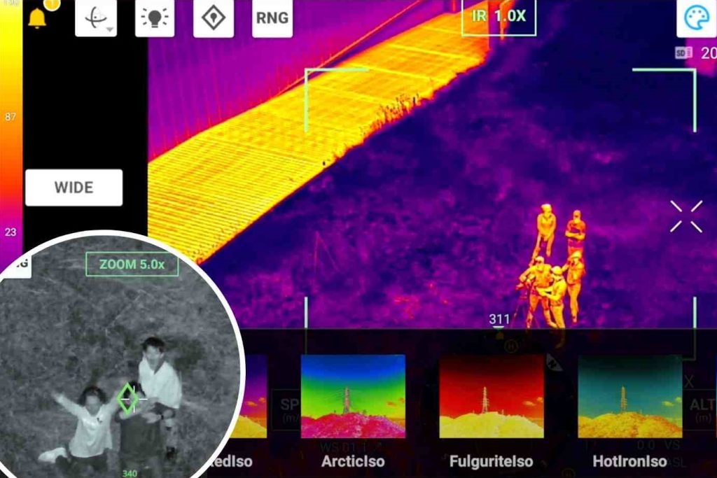
In search missions, the combination of thermal detection and high-powered zoom is essential. Our DJI M30T integrates these technologies into a single system:
1. High-Resolution Thermal Imaging
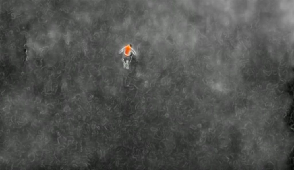
With our radiometric infrared camera, we detect heat signatures in inhospitable terrain or low visibility (night, dense vegetation). Even minute temperature differences between a person and their surroundings are visualized in sharp detail, significantly increasing the probability of localization.
2. 200x Hybrid Zoom & Laser Rangefinder
Our powerful zoom allows us to identify suspicious objects or persons from a great distance without physically moving the drone (preserving silence in the search area). The built-in laser rangefinder provides exact GPS coordinates of a location instantly, which we immediately relay to ground teams.
Live Monitoring: Real-Time Decision Making
In critical operations, information processing is key. Droneview.be provides a mobile command setup to aid coordinators:
- External 32” Monitor: Emergency services, police, or stakeholders can watch the camera feed live on a large screen during the flight.
- Efficient Coordination: This enables instant image interpretation, allowing search actions to be redirected immediately based on real-time findings.
Limitations and Accountability
While our drones are powerful tools, Droneview.be acts strictly as a technical facilitator. We do not provide legal analyses or investigative conclusions; we provide our equipment and expertise to official agencies. Our role is supportive: providing the “eyes in the sky” to maximize the efficiency of ground-based search teams.
Advantages of Droneview.be for SAR Operations:
- Speed: Rapidly scan large areas (forests, fields, water surfaces) that would take ground teams hours to cover.
- Night Vision: Full operational capacity in total darkness thanks to radiometric thermography.
- Safety: Inspect dangerous areas (marshes, cliffs, unstable structures) without risking human life.
- Detailed Evidence: All footage is recorded in high resolution for later evaluation by authorized investigators.
See the DJI M30T in Action
Our latest drone provides unprecedented stability and image quality, even in challenging weather conditions.
Need Professional Support?
For urgent assistance or technical support during search operations, Droneview.be is ready with the latest technology.