Technical Drone Inspections for Industry & Construction in Belgium
Droneview.be supports construction companies, energy operators, and property managers with thermal inspections, 3D mapping, and advanced drone data analysis. We deliver irrefutable data to back your project decisions.
EASA-certified operations in compliance with Belgian drone regulations. Every project is delivered via an interactive client portal for direct analysis and measurements.
Why your site manager wastes 80% of their time on measurements
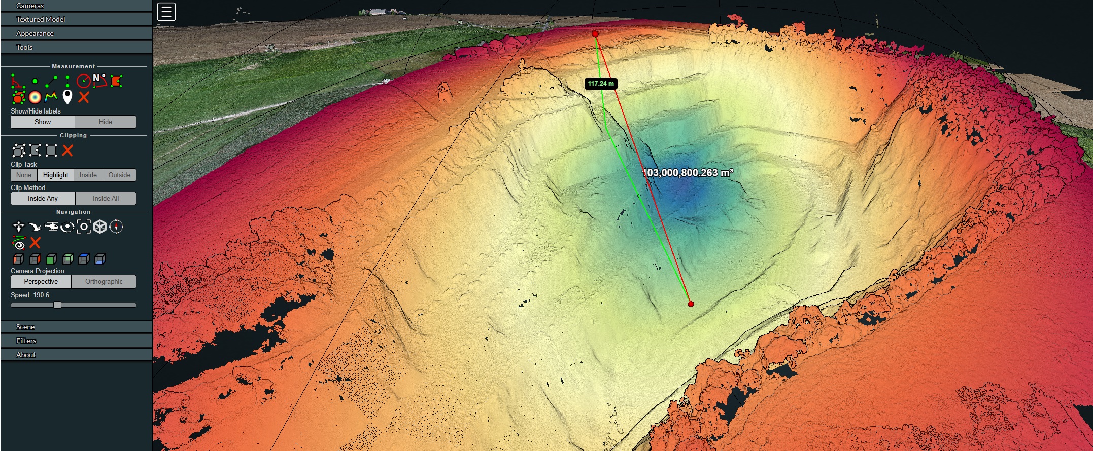
Traditional surveying is slow and often hazardous. While your team manually plots points, you lose valuable hours. With DroneView.be technology, you measure volumes from 300 m³ to 100 million m³ in seconds, directly in your browser.
- Cloud-based: No heavy software needed, accessible on any device.
- Objective evidence: Prevent disputes over earthworks with 3D visibility.
- Scalable: From small construction pits to quarries 117m deep.
Accurate Stock Management & Counter-Expertise
Do you trust your supplier’s scales, or reality? Rainwater and human error affect weight, but not the actual m³ on your site.
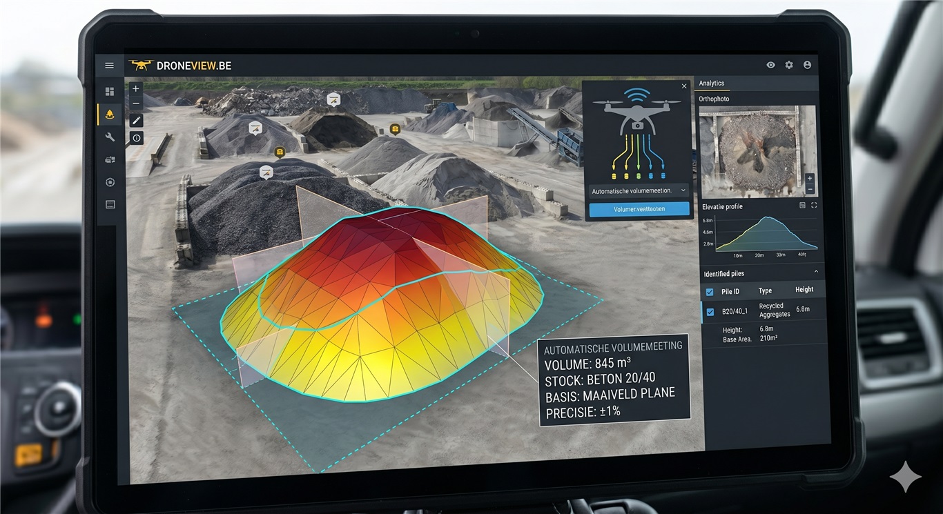
Independent measurement: Compare weighing tickets with objective 3D volume measurements (99% accuracy).
Instant insight into stockpiles of concrete rubble, crushed sand, or earthworks without risky manual measurements on unstable slopes.
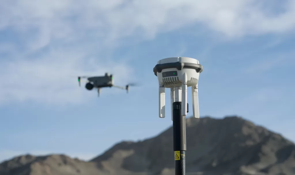
High-Precision RTK Technology
For projects where every centimeter counts, we work with our own D-RTK 2 Multifunctional Station. This guarantees survey-grade precision, even on complex industrial sites — including urban environments and areas with signal interference.
Survey Preparation
Perform elevation measurements and leveling plans directly from your office with centimeter precision. Ideal for earthworks, excavations, and quote preparation.
Digital Twin Demo
Calculate volumes and distances yourself in our photo-realistic cloud environment.
View Live Demo →
Who do we work for?
Our projects speak for themselves
Examples from Flanders and Wallonia
☀️
Inspection of 500 solar panels
12 defective panels detected in less than 2 hours — before the maintenance team arrived. The investment paid for itself immediately.
⛏️
3D mapping of a quarry
1,750 images processed into a measurable 3D model. Volume calculations that used to take half a day of field work are now performed from the office.
🏗️
Quotation prep for earthworks
A contractor from Antwerp saves hours of field work per quotation. Elevation differences and volumes are now accurately measured from the office.
Why large projects choose Droneview.be
- ✅ Measurable and reproducible data — suitable for technical reporting and internal project control
- ✅ Operations compliant with Belgian drone regulations using professional equipment
- ✅ No scaffolding, no cherry pickers, minimal operational disruption
- ✅ Time and cost savings — up to 80% faster than traditional surveying
- ✅ Certified drone data for BREEAM support, EPC audits, and industrial inspections
- ✅ Interactive client portal — no need to send large files; you get a secure cloud environment to measure, zoom, and report
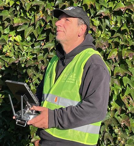
“Thirty years in the mud, now with a view from above.”
“Having spent 30 years as an independent contractor in earthworks, I know better than anyone that a site succeeds or fails on the accuracy of its numbers. I spent years with a surveying rod in my hand, dealing with endless disputes over cubic meters. I don’t sell photos; I deliver the data I wish I’d had back then to work more efficiently and safely.”
— Guy Liebert, Managing Director Droneview
Our Expertise
Solar Inspections
Detection of hotspots, string errors, and yield loss in industrial solar parks. Analysis without production downtime.
Building Thermography
Locating thermal bridges, insulation leaks, and water ingress. Suitable for technical audits and renovation planning.
3D Mapping & Volumes
As-built documentation, point clouds, and terrain models for BIM integration, site monitoring, and stock management.
Search & Rescue
Real-time thermal support for professional search operations for missing persons.
What our clients say
★★★★★
5.0 / 5 · 7 Google reviews ·
View on Google →
“Thanks to Droneview, we detected faulty panels before the maintenance team arrived. The investment paid for itself immediately.”
Energy Company, Limburg
“The 3D models save us hours of field work during tender preparation. We now measure height differences and volumes accurately from our office.”
Contractor, Antwerp
“Recently had drone shots taken of my house, including heat loss analysis. The result was impressive — crystal clear images and valuable insights.”
Wim Dewever · Local Guide
“They were on board from the first phone call. Not a simple task, but I am very satisfied with the process and the result!”
Marc Van Loey
Satisfied customer?
Leave a Google review here →