3D real estate presentation drone

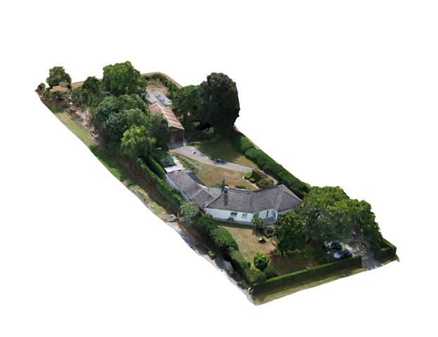
Exclusive Real Estate: Interactive 3D Experience of a Luxury Villa

In the competitive world of high-end real estate, a standard photo series is often not enough to convey the full experience of a property. For this project, Droneview.be created a detailed 3D Digital Twin of an exclusive villa, allowing potential buyers to virtually visit the property and admire the architecture from every angle.


The Added Value for the Real Estate Sector

Traditional real estate presentations remain limited to 2D images. By using drone photogrammetry, we offer a solution that:

  • Creates an experience: Buyers get a unique perspective on the villa’s placement within its surroundings.
  • Accelerates decisions: Serious prospects can explore the property online beforehand, leading to higher-quality viewings.
  • Exudes exclusivity: An interactive 3D environment elevates the presentation to a higher level, fitting for the luxury real estate segment.

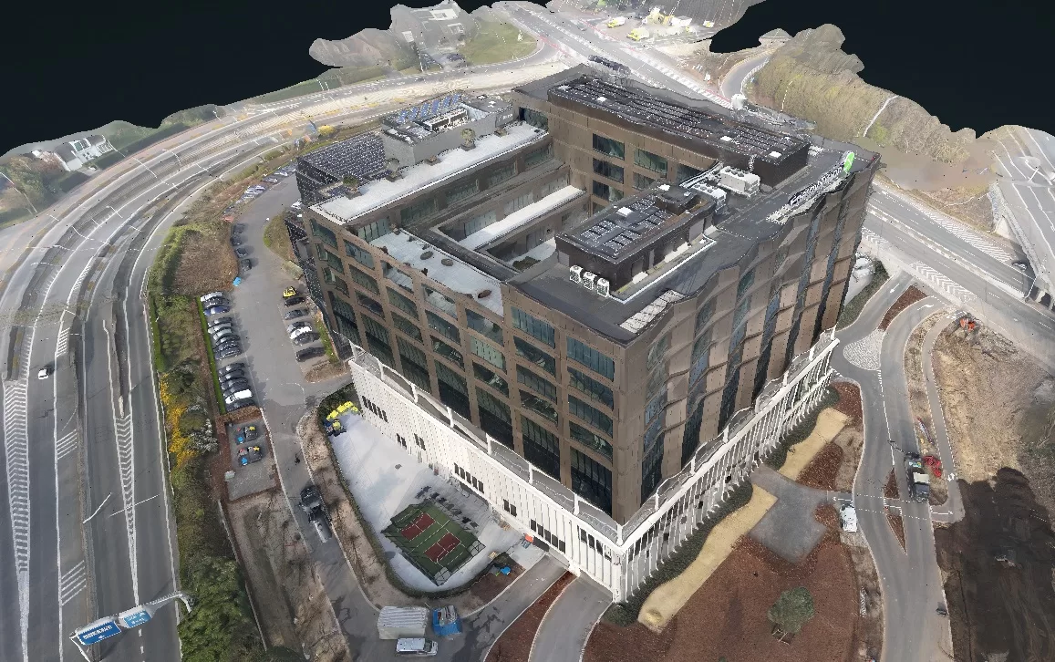
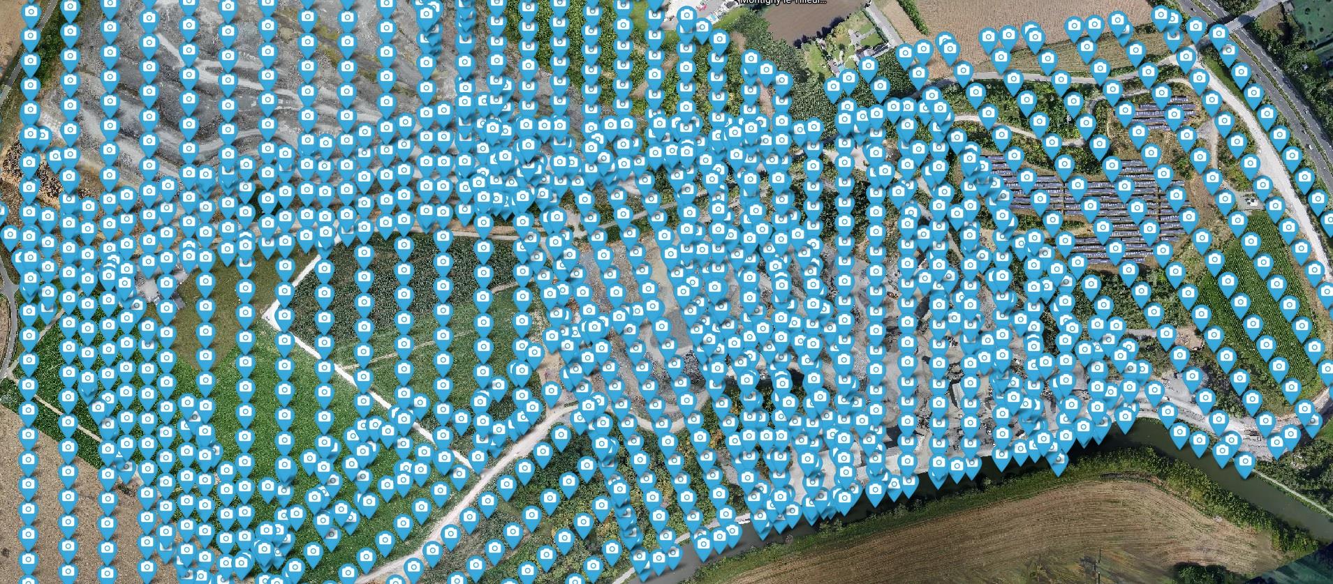
Our Approach: From Aerial Imagery to Property Experience

To bring this villa to life, we performed a series of precision flights capturing both facade details and garden architecture.

  • Focus: Aesthetic precision and realistic texture rendering.
  • Technology: 3D Mesh reconstruction based on high-resolution drone photos.
  • Result: A smoothly navigable model accessible on both desktop and mobile.
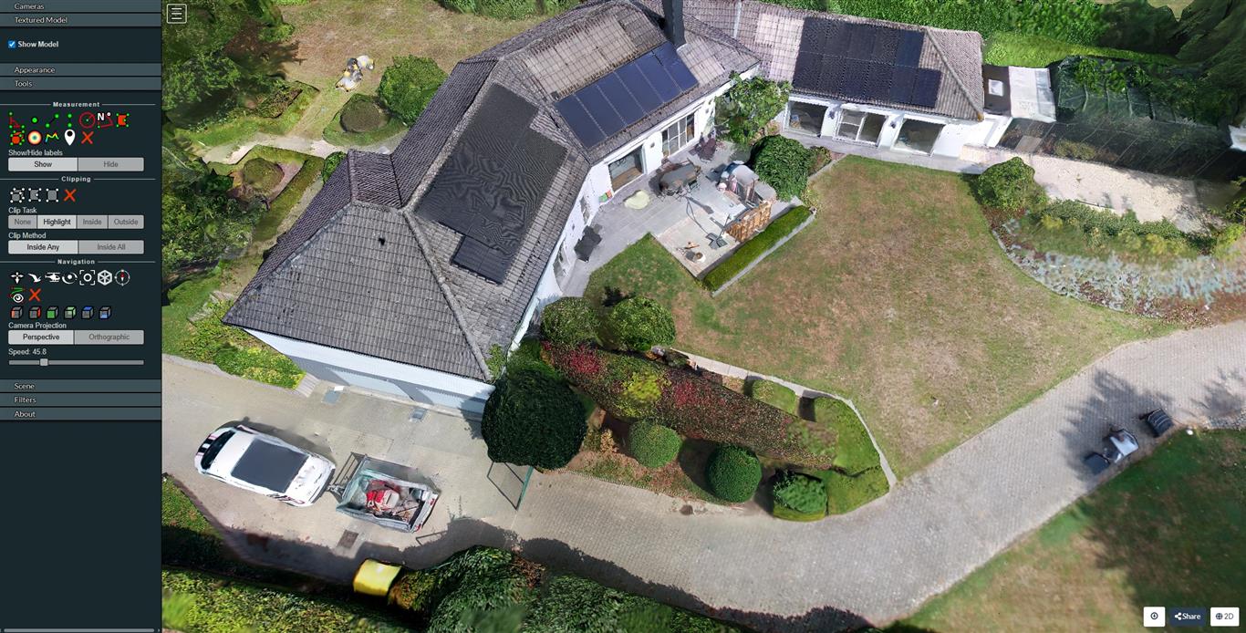
High resolution 3D Mesh


Interactive 3D Demo

Experience the architecture yourself. Click the link below to open the interactive environment and navigate freely around the villa.

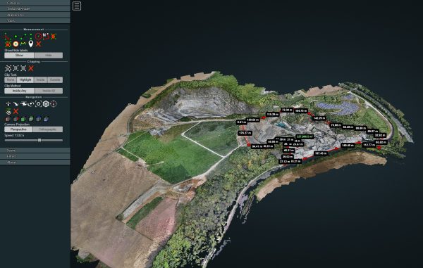
Privacy & Discretion: To ensure the owner’s privacy, all GPS coordinates and location metadata have been completely removed from this public demo model. As a result, the built-in measurement functions (such as distances and areas) are not active in this specific example. In an official commercial project, this data is naturally retained for full technical analysis.

👉 View the interactive 3D environment of the villa here


Project Details (Real Estate Marketing)

Feature Description
Application High-end Real Estate Presentation
Target Audience Realtors & Project Developers
Technology 3D Photogrammetry
Platform Web-based (No software required)

Thermal Digital Twin EGEON

Project EGEON: Thermal Digital Twin for BREEAM Certification

For the EGEON project, Droneview.be conducted an advanced thermal drone inspection. The objective was not merely to capture images, but to create a complete Digital Twin based on radiometric data. This report served as technical substantiation for the building’s BREEAM certification file.


The Challenge: Detecting Invisible Heat Loss

For large-scale buildings like this one, manually tracing insulation anomalies and thermal bridges is an impossible task. The client required a system that:

  • Detects thermal deviations at great heights and on hard-to-reach facades.
  • Directly localizes data spatially within a 3D model.
  • Provides absolute temperature measurements for technical validation.

Our Methodology: Radiometric 3D Mapping

Using the DJI M30T, we performed a combined flight (thermal + visual).

  • Dataset: 1,321 captures processed into a point cloud of over 20 million measurement points.
  • Resolution: A razor-sharp visual GSD of 2.49 cm/px and a thermal GSD of 9.24 cm/px.
  • Validation: Use of the Ironbow palette and DJI Thermal Tool v3 for absolute temperature measurements at an emissivity of 0.95 (bitumen/concrete).

Digital Twin Visual
Digital Twin Visual
Digital Twin Thermal

Interactive Digital Twin & Reports

In this project, we go beyond a static report. We deliver an interactive environment where every pixel contains data.

👉 Interactive 2D Inspection Map (Orthomosaic)

👉 Open the Thermal 3D Digital Twin


Technical Project Details

Parameter Specification
Inspection Type Thermography & 3D Digital Twin
Software WebODM & LGT Engine 4.1.8
Reconstruction 20,359,244 3D measurement points

Quarry Volume Measurement

Industrial Site Mapping: Volume Measurement and Digital Inventory of a Quarry

For this large-scale project, Droneview.be transformed an active 120-hectare mining site into a highly accurate digital terrain model. Where traditional surveying on this scale takes weeks, our drone data delivers a complete overview for efficient stockpile management and site monitoring within days.


The Challenge: Efficiency and Safety in Complex Environments

In a dynamic work environment like a quarry, safety is a priority. The client sought a method to collect accurate data without halting operational activities. Key requirements included:

  • A high-resolution baseline measurement of the entire topography.
  • Calculation of stockpile volumes with minimal margin of error.
  • Accessible data for project managers without the need for heavy CAD software.

Technical Workflow: Photogrammetry at Scale

Data acquisition was carried out via pre-programmed flight paths, ensuring consistent overlap and GSD (Ground Sample Distance).

  • Data Scope: Processing 1,750 RAW images for maximum clarity.
  • Processing: Advanced reconstruction via the WebODM engine for a reliable point cloud model.
  • Deliverables: Georeferenced orthophotos, Digital Surface Models (DSM), and Terrain Models (DTM).
Quarry mapping orthophoto
Detailed orthophoto for precise terrain analysis.
Drone flight path positions
Visual representation of flight route and camera positions.

Interactive Analysis & Visualization

By converting the massive dataset into an interactive 3D environment, the client can calculate distances, areas, and volumes in the browser at any time.

👉 Launch the interactive 3D viewer of the quarry

Need help? Check out our WebODM Viewer Manual.

Project Details (Terrain Analysis)

Feature Specification
Surface Area 120 Hectares
Capture Count 1,750 High-Res photos
Technology 3D Photogrammetry (WebODM)
Output Orthophoto, DTM, DSM & 3D Mesh

Retail Real Estate Portfolio

Commercial Real Estate: Portfolio Photography for Developers

For a leading property developer, Droneview.be provided an extensive photo report of various completed retail projects. By capturing well-known brands such as Jumbo, Action, Lidl, and Spar from the air, we perfectly highlight the scale and strategic location of these commercial sites across multiple locations.


The Challenge: High-Level Property Presentation

When selling or leasing commercial properties, the first impression is vital. A developer needs visuals that emphasize not just the building, but also the surroundings and accessibility:

  • Contextual Factors: Showcasing parking facilities, access roads, and nearby infrastructure.
  • Brand Visibility: Professionally highlighting the branding of major retail anchors to attract new tenants.
  • Consistency: Maintaining high image quality across a diverse portfolio of locations.

Our Approach: High-End Aerial Photography

Using our drones, we fly at various altitudes and angles to obtain the most flattering and informative images for marketing purposes and annual reports.

  • Technique: HDR aerial photography for clear images, even in challenging lighting conditions.
  • Post-processing: Professional color correction and retouching for a clean, commercial look.
  • Efficiency: Quick deployment between different sites to build a complete portfolio rapidly.

Result: A Powerful Sales Tool

The delivered images provide the developer with powerful visual proof of their expertise, demonstrating their ability to successfully realize and manage projects for major international chains.

Project Details (Retail Real Estate)

Feature Description
Sectors Retail, Commercial Real Estate
Brands Jumbo, Action, Lidl, Spar, etc.
Service Architectural & Aerial Photography
Application Marketing, Portfolio Building, Property Sales

Thermal façade and roof inspection of a residential property

Thermal imaging of a residential façade revealing thermal bridges above windows and heat patterns from indoor radiators

During this residential inspection, we meticulously mapped the energy efficiency of the building envelope. By combining a certified thermal drone (for the roof and higher sections of the façade) with a handheld thermal imaging camera (for the interior), invisible energy losses are instantly brought to light.

What do these thermal images reveal?

Thermal images (thermograms) record infrared radiation and translate temperature differences into a clear color palette. On the project images above, we can identify several classic energy efficiency pain points:

  • Massive thermal bridges above the windows: On the rear façade photo, the zones directly above the window frames light up in bright yellow and orange. This indicates a clear gap in the insulation at the lintels (support beams), allowing valuable heat to escape unobstructed.

  • Visible radiator heat through the outer wall: Look closely at the areas underneath the windows on the façade photo. The bright, warm glow reveals exactly where the indoor radiators are located. Because the walls behind radiators are often subjected to intense local heating, the heat radiates out through the uninsulated exterior brickwork at an accelerated rate.

  • Heat loss through the roof and skylight: The roof photo shows a bright, yellow-white outline around the Velux skylight and a continuous warm strip along the ridge line. This is conclusive evidence of an inadequate insulation barrier or rising warm air escaping through air gaps.

Thermal drone inspection of a roof showing heat loss along the ridge line and around the skylight

Why choose a thermographic drone inspection?

A visual inspection or a traditional energy performance certificate (EPC) will tell you that heat is being lost, but guessing where exactly it happens remains a challenge. A targeted thermal imaging inspection locates defects down to the centimeter, without any destructive testing. This provides the ideal foundation for targeted renovation works or an independent quality control check following insulation upgrades.