High-Precision Cross-Hatch Thermal Drone Inspection PV System (485 kWp) – Finaspan NV

thermografische-drone-inspectie-zonnepanelen-boortmeerbeek.jpg

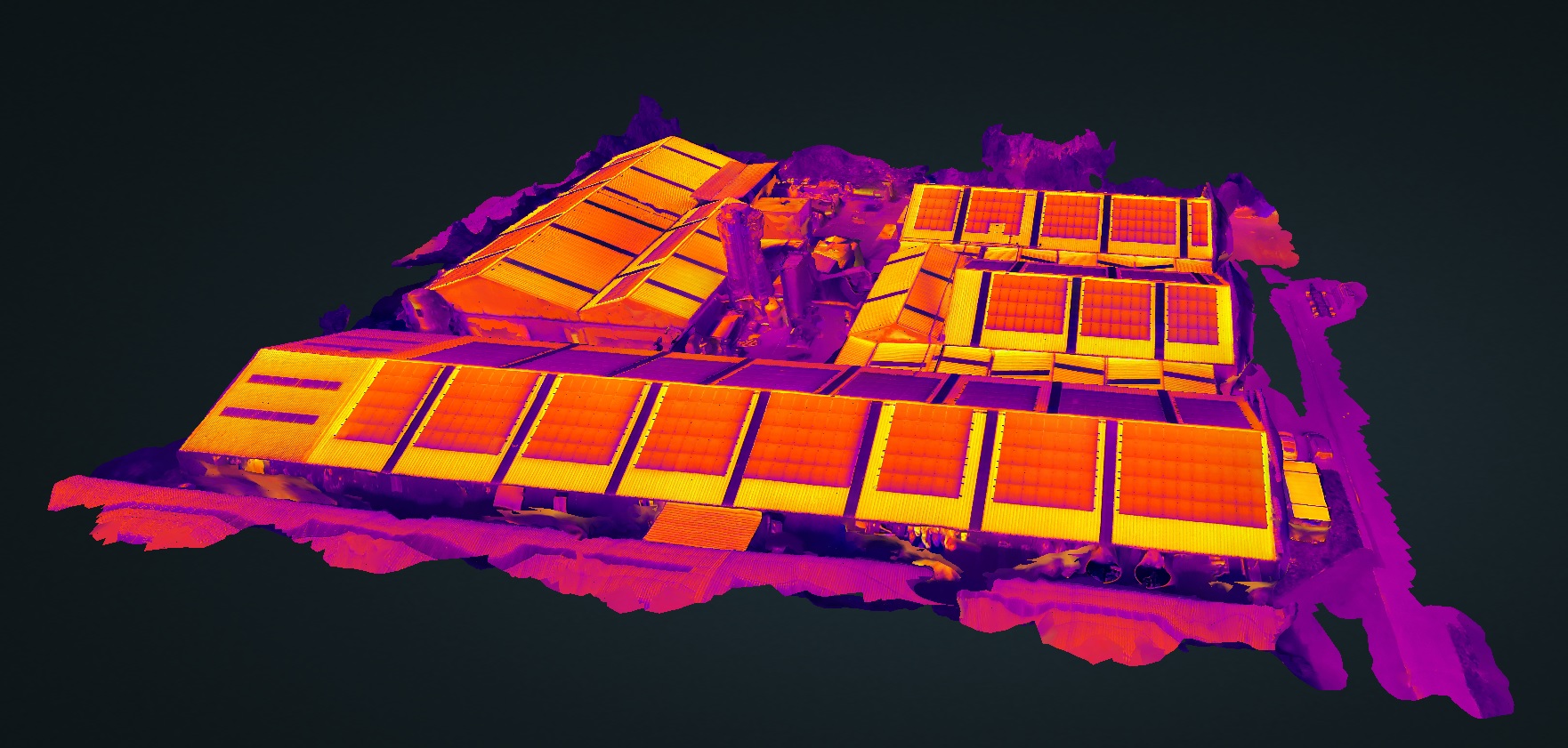
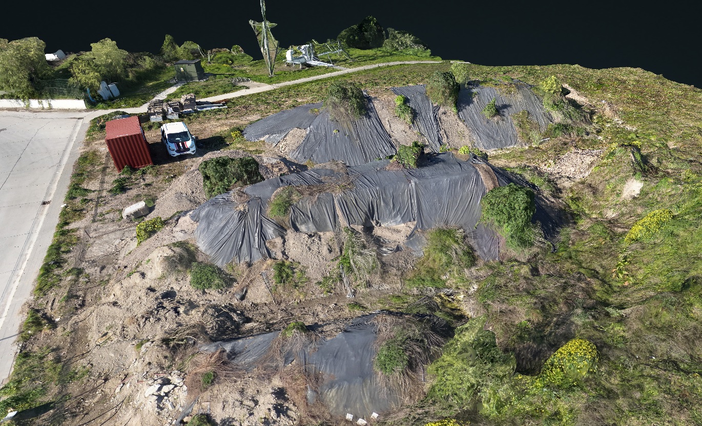
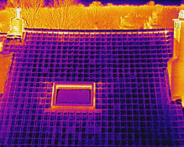
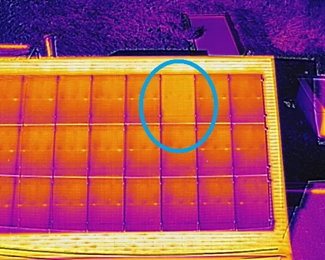
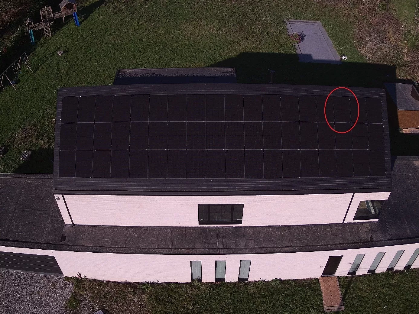
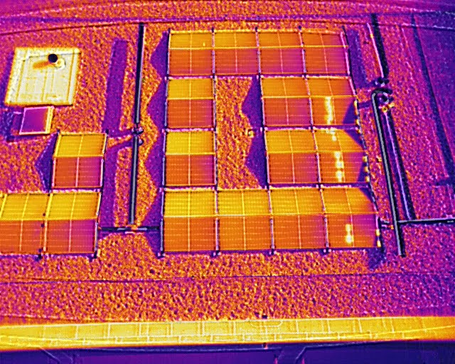
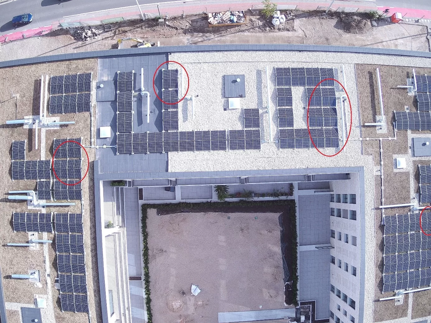
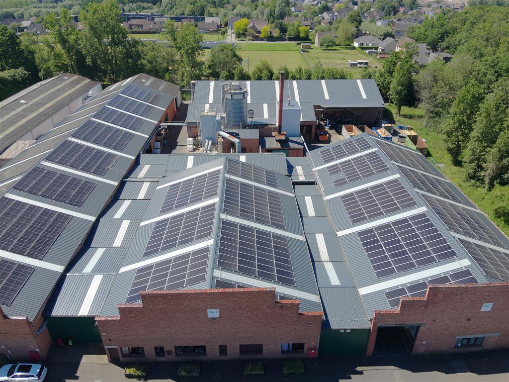
For Finaspan NV in Boortmeerbeek, Droneview.be performed a high-precision thermal and electrotechnical inspection of an industrial solar panel installation of approx. 485 kWp (1,180 panels).

IronRed

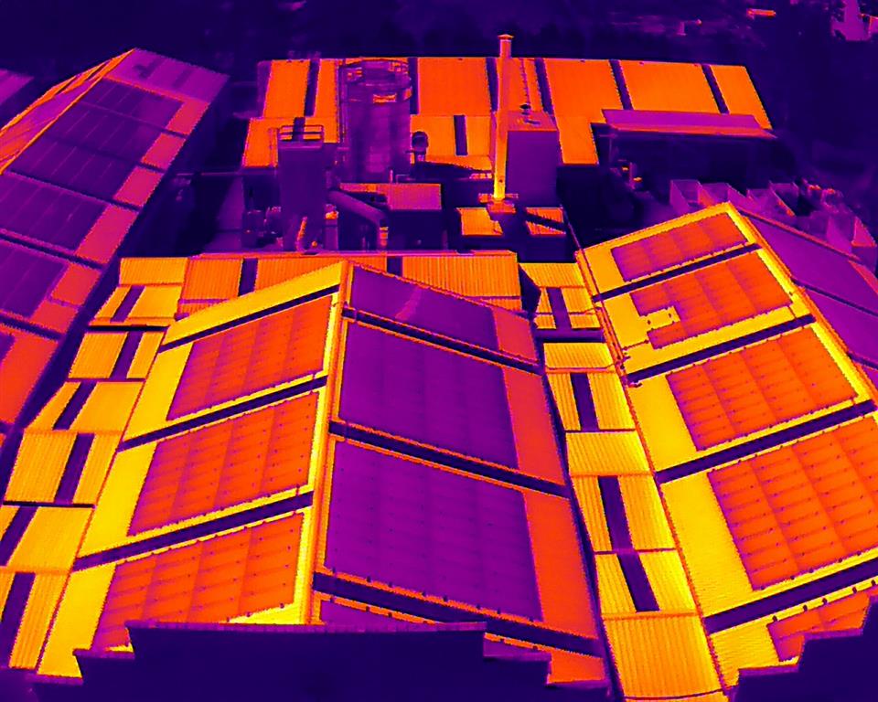
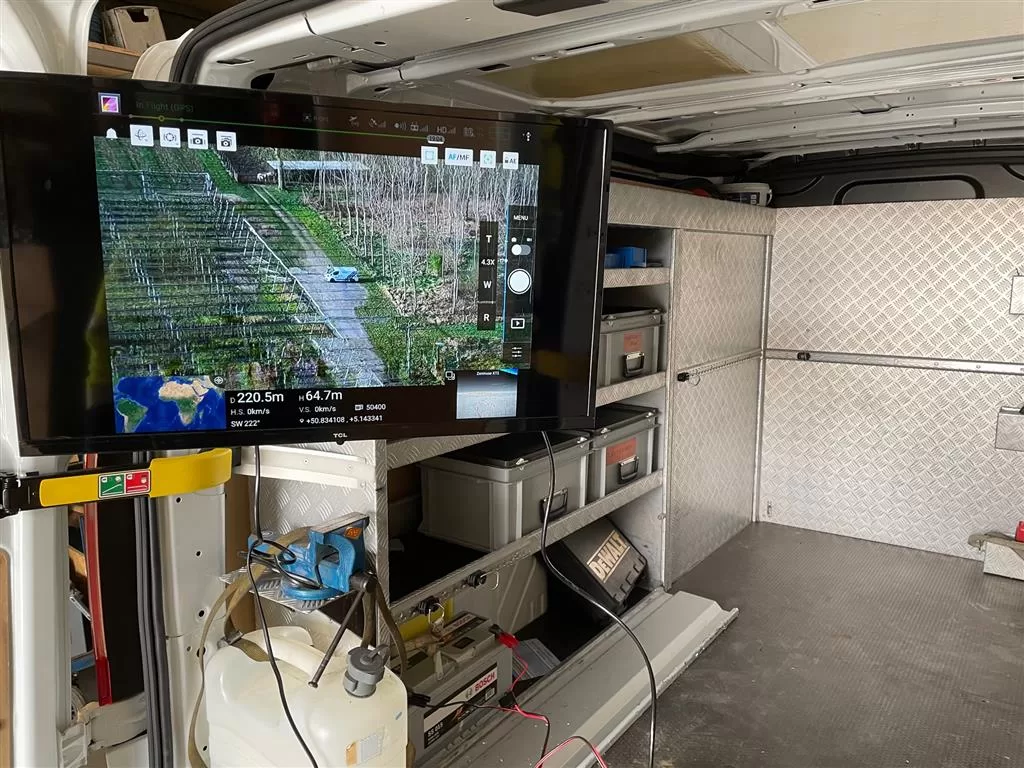
Using our DJI Matrice 30T drone, a dual, automated cross-hatch flight grid was executed at an altitude of 30 meters. This resulted in an extremely dense dataset of 530 radiometric (R-JPEG) infrared and visual images.

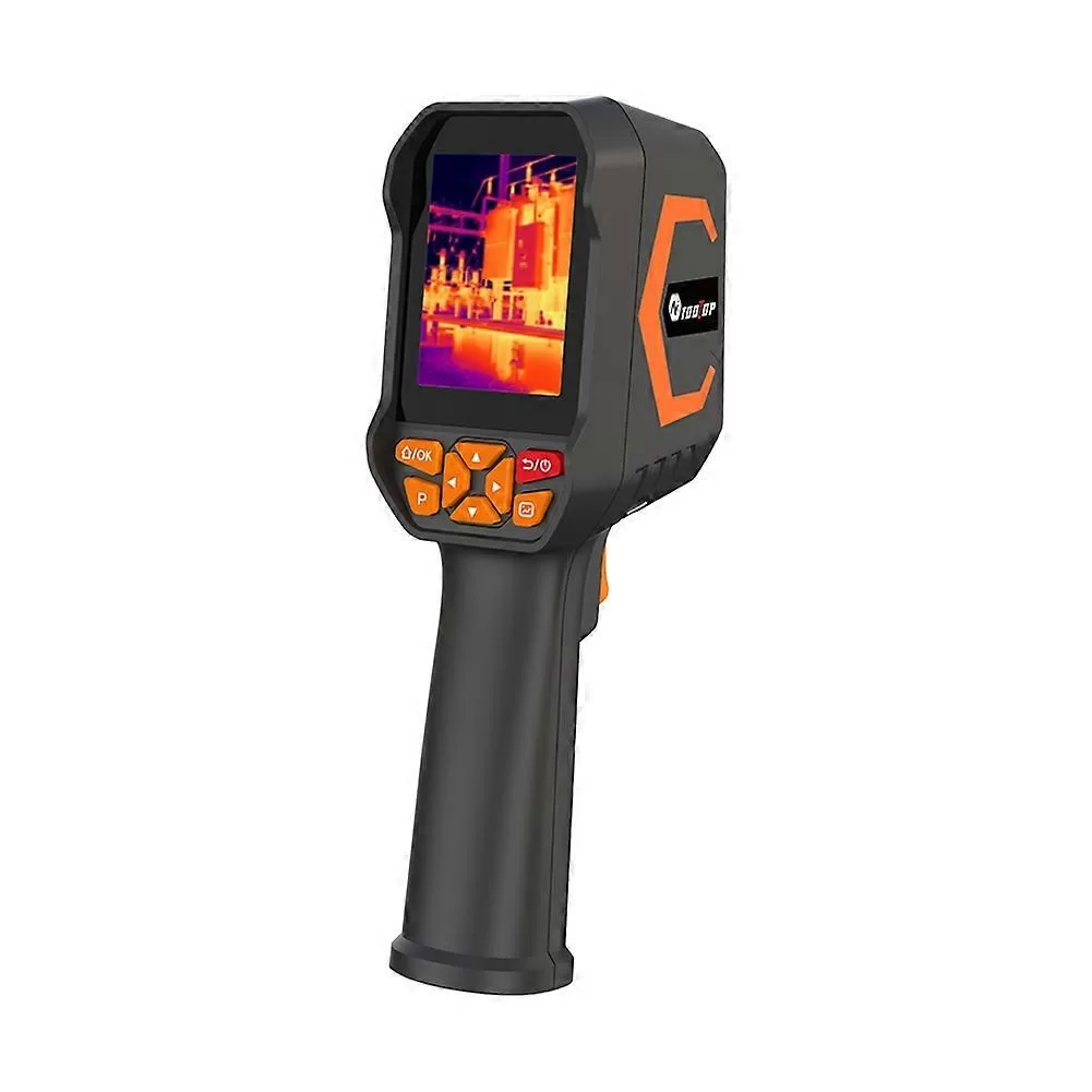
By directly linking the real-time string data from the Huawei FusionSolar inverters to our thermal and visual WebODM 3D Digital Twins, we were able to uncover crucial technical anomalies without physically entering the roof. Among other things, a critical reverse current (-1.77 A) and a high internal inverter temperature (75.5°C) were localized inside the plant’s technical room. With this targeted drone data, installer MR Solar can now maintain the installation efficiently and purposefully for yield management and fire prevention.

Interactieve 2D orthomosaic en 3D Digital Twin van een PV-installatie in de WebODM-viewer.

The Digital Heart of Europe – Press Assignment

For an press agency, I received the unique assignment to document one of the most secure and strategic locations in Belgium: the Google Datacenter campus in Saint-Ghislain. Although the site itself is strictly closed to the public, we captured the massive scale of this project with precision from legal flight zones surrounding the perimeter.

A Giant on Belgian Soil What you see here is not just an industrial estate. It is one of the most important hubs of the global internet. The Saint-Ghislain campus was Google’s first European datacenter, opened in 2009, and has since grown into a giant supporting the digital needs of millions of users across Europe, the Middle East, and Africa (EMEA).

Key facts about this site:

  • Surface Area: The campus now covers approximately 90 hectares (over 130 football fields).

  • Investment: Google has invested more than €3 billion in the Belgian site to date.

  • Capacity: The site currently houses five massive datacenter buildings. Construction is already underway on an adjacent plot to nearly double the existing capacity.

  • Sustainability: It is one of the most efficient datacenters in the world, using an advanced water-cooling system from the nearby canal, eliminating the need for energy-intensive air conditioning.

  • Employment: The site directly employs 400 to 500 specialists, with hundreds of additional indirect jobs created through ongoing construction.

The Mission: Visual Precision For this assignment, we utilized the DJI Matrice 30 for ultra-sharp zoom images and the DJI Avata for an immersive 360° experience. This allowed us to document the expansion works and infrastructure in high detail while remaining strictly outside the no-fly zone.

Haspengouw in bloom – A unique perspective on Duras

The Fruit Region as you’ve never seen it before. At Droneview.be, we are proud of our hometown. Our base, the picturesque Duras in Sint-Truiden, lies at the heart of the Haspengouw fruit region. During the blossom season, this region transforms into an unprecedented white and pink splendor, a setting we are privileged to admire and fly through every day.

The 360-degree experience

For this project, we wanted to capture the peace and vastness of Duras in an innovative way. A standard photo only tells half the story. With our specialized 360° technology, we invite you to look around for yourself.

  • Explore the horizon: From the rolling orchards to the historic contours of the landscape.

  • Experience the serenity: Feel the peace of the “green lung” of Limburg from the air.

  • Details in depth: Discover the details that remain hidden in traditional photography.

Interactive experience: Click and drag in the image below to take a full 360-degree tour of the Duras blossom landscape.


Why 360° photography?

This technique goes beyond just pretty pictures. It offers full context. Whether it’s promoting tourist assets, mapping out vast terrains, or capturing architectural heritage; the viewer is literally at the center.

At Droneview.be, we combine our passion for the region with the latest technology to showcase your project – large or small – from an unprecedented perspective.

Thermal drone inspection of a 2 MW solar farm in Charleroi

For this large-scale industrial project, we conducted a comprehensive thermographic inspection of a solar power plant with a capacity of approximately 2 MW in Charleroi. Utilizing our specialized thermal drone, we efficiently scanned thousands of PV modules in a fraction of the time to pinpoint potential anomalies and hotspots.

Apart from a few defective solar cells (hotspots), the entire installation was found to be in excellent operational condition. This preventative drone audit allows the asset manager to schedule targeted maintenance, preventing yield loss and ensuring maximum fire safety.

Technical Survey & Volume Measurement EFI Global

Commissioned by EFI Global, Droneview.be performed a detailed drone inspection and volume measurement in Beersel. This project highlights the vital role of drone data in technical surveying and insurance claims, where precision and objective evidence are paramount.


The Challenge: Accurate Data for Loss Adjusting

In technical surveys, capturing the actual site conditions flawlessly is essential. For this case, EFI Global required:

  • High-Resolution Baseline: A detailed site overview with a GSD of 0.83 cm/pixel.
  • Objective Volumetrics: Exact m³ determination of specific stockpiles for damage or inventory assessment.
  • Digital Reconstruction: A point cloud exceeding 16 million points for further analysis.

Project Details (Survey Mapping)

Feature Specification
Client EFI Global
Location Beersel, Belgium
Technology Matrice 30T & Droneview Engine 4.2.0
Point Cloud 16,464,132 points

Drone stockpile volume management

Periodic Stock Management: Digital Inventory of Bulk Materials in Beringen

For a long-term client in Beringen, Droneview.be provides regular monitoring of their bulk material stocks. By periodically mapping the site with drones, the client always has an up-to-date digital inventory and an exact overview of available volumes in cubic meters (m³).


The Challenge: Manual Measurement vs. Digital Precision

Visually estimating or manually measuring large piles of sand, gravel, or aggregates is error-prone and time-consuming. Our client needed a system that offered:

  • Speed: Measuring the entire stock without disrupting site operations.
  • Reliability: Accurate volume calculations directly usable for accounting and logistical planning.
  • Reporting: A clear overview per material type in an easy-to-read report.

Our Solution: Drone Photogrammetry & Volumetrics

During each measurement cycle, we generate a detailed 3D reconstruction of the stockpiles. Using advanced software, we calculate each volume with centimeter-level precision.

Stockpile volume measurement Beringen


  • Data Acquisition: Fast drone flight over storage zones.
  • Analysis: Calculation of ‘cut & fill’ volumes based on a digital surface model.
  • Output: A detailed PDF report and CSV export with the exact m³ per stockpile.


Direct Impact for the Client

Thanks to our reporting, the client knows exactly how much material is available. This prevents shortages, optimizes purchasing, and ensures flawless internal inventory management. It is the ultimate combination of technology and practical site management.

Project Details (Stock Management)

Feature Description
Location Beringen, Belgium
Frequency Periodic monitoring
Technology High-res aerial photogrammetry
Output Volume reports (m³), Orthophoto & CSV data

Industrial Inspection INEOS

Industrial Inspection at INEOS: Drone-Assisted Maintenance of Silos and Installations

For the production site of INEOS in Geel, Droneview.be conducted an intensive inspection day. Using advanced zoom technology, we mapped critical components of silos, towers, and complex industrial installations without the need for scaffolding or aerial work platforms.


The Challenge: Safety and Speed in Maintenance

In a high-tech environment like INEOS, preventive maintenance is crucial. The challenge with traditional inspections is the accessibility of installations at significant heights.

  • Safety: No human risks associated with working at heights.
  • Efficiency: Inspecting multiple installations in a single day.
  • Detail: Detecting minute defects such as early-stage corrosion (rust), hairline cracks, or loose bolts from a great distance.

Industrial Silos INEOS Geel

Defect detection zoom camera

Our Approach: Live Interaction and High-Power Zoom

During this mission, we deployed the DJI M30T. The strength of this drone lies in the combination of mobility and its powerful zoom camera.

  • Real-time collaboration: The maintenance manager could follow the inspection live on a large screen in our mobile command post (van).

Live monitoring station

  • Targeted inspection: Guided by the engineer, we could immediately zoom in on specific flanges, welds, or support points.
  • Data capture: Every finding was directly recorded in high resolution for further analysis in the maintenance plan.

Direct Impact for the Client

The live interaction between the drone pilot and the maintenance manager allowed for on-site decision-making. The drone functioned as the engineer’s “eyes in the sky,” resulting in enormous time savings and a complete overview of the technical state of the site.


Project Details (Industrial RVI)

Feature Description
Location INEOS, Geel
Inspection Type Remote Visual Inspection (RVI) at height
Equipment DJI M30T (High-res Zoom & Thermal)
Special Feature Live-view monitoring in mobile station

Thermal drone inspection home

Thermal Building Analysis: Detecting Heat Loss in Woluwe-Saint-Pierre

For a residence in Woluwe-Saint-Pierre, Droneview.be conducted a comprehensive thermal insulation audit. By deploying both a thermal drone and a handheld thermal imaging camera indoors, we accurately mapped where the building loses energy and where the insulation falls short.


The Challenge: Increasing Comfort and Reducing Energy Costs

The owner wanted an objective view of the energy status of the home. The focus was on:

  • Identifying thermal bridges and insulation defects.
  • Detecting heat loss at the roof and around windows.
  • Detecting potential moisture-related issues invisible to the naked eye.

Our Methodology: Dual Thermal Inspection

For a 100% reliable result, we combined two techniques:

  1. Aerial Analysis (Drone): Using the DJI M210T, we inspected the roof shell and the upper floors. This revealed clear leaks at the roof ridge and around the Velux skylight.
  2. Interior Inspection (Handheld): Using a manual thermal camera, we checked the interior. This confirmed thermal bridges above the windows that were less visible from the outside.

Handheld thermal camera


Key Findings

The inspection provided crucial insights for renovation planning:

  • Roof Insulation: Significant heat leakage along the entire ridge line.
  • Glazing: The thermal signature confirmed the presence of double glazing but also showed that an upgrade to high-efficiency glass would have a major impact on comfort.
  • Moisture Detection: Thermal anomalies were found indicating moisture accumulation, extending beyond the already visible spots on the wall.
Roof insulation inspection
Thermal bridge
Handheld check of thermal bridge

Project Details (Residential Inspection)

Feature Description
Location Woluwe-Saint-Pierre
Inspection Type Thermal insulation check (Interior + Exterior)
Equipment DJI M210T & Handheld IR Camera
Result Detailed report with renovation advice

Drone inspection defective solar panel

Rapid Fault Detection in PV Systems: Preventing Yield Loss in Le Roeulx

During the final commissioning of a brand-new installation in Le Roeulx, an error message was detected on the inverter. Instead of the installer having to manually measure each of the 54 panels on the roof, Droneview.be completed the job from the air in just a few minutes.

This is a brilliant example of the direct return-on-investment (ROI) that a drone inspection provides.


The Challenge: A Needle in a Haystack

When a new solar panel installation shows a defect, the installer faces a time-consuming task. To find the faulty panel, all panels often have to be disconnected and measured one by one. This means:

  • Hours of work on a pitched roof.
  • High labor costs and safety risks.
  • Prolonged yield loss for the end customer.

Our Solution: Real-Time Thermal Detection

Using the DJI M210 and the radiometric Zenmuse XT2 camera, we flew over the installation under optimal sun conditions.

  • Speed: The entire field was scanned within a single flight of a few minutes.
  • Result: One specific panel (3rd from the right on the top row) showed an anomalous thermal pattern, indicating a full short circuit or a faulty bypass diode.
  • Visual Verification: Thanks to simultaneous RGB recording, we could confirm there was no visible damage (such as glass breakage), pointing to an internal technical defect.

Major Savings for the Contractor

Thanks to the exact localization, the technician from Ecochauffage could head straight to the correct panel. What could have normally been a day’s work was reduced to a quick 30-minute intervention.

Thermal anomaly solar panel

Visual check solar panel

Project Details (Quick Scan)

Feature Description
Location Le Roeulx
Client Ecochauffage SRL
Installation 54 panels (Residential/SME)
Findings 1 fully defective panel localized

Large-scale solar panel thermal inspection

Thermal Inspection of Large-Scale Solar Panel Installations in Mechelen

For contractor Noven, Droneview.be conducted a detailed thermal audit on an extensive PV installation in Mechelen. This project focused on detecting production errors and installation damage to ensure the maximum yield of the new installation.


The Challenge: Detecting Defects in New Installations

Even with brand-new solar parks, invisible defects can be present due to transport, placement, or manufacturing errors. For Noven, it was essential to:

  • Perform a baseline measurement (zero-point) after installation.
  • Locate specific hotspots and defective bypass diodes that are invisible to the naked eye.
  • Prepare a technical evidence file for potential warranty claims with the manufacturer.

Our Methodology: High-Res Thermography & Zoom

For this assignment, we deployed the DJI M210, equipped with a dual-camera system:

  • Zenmuse XT2 Thermal Camera: For capturing accurate temperature differences across the entire PV field.
  • Zenmuse Z30 Zoom Camera: For extremely detailed visual inspection of individual cells without having to step onto the roof.
  • Analysis: The installation was divided into zones (A to F) to report anomalies exactly to the installer.

Solar panel field Mechelen

Thermal inspection solar panels Noven


Results & Findings

During the inspection, several critical points were uncovered:

  • Production Errors: Repeated hotspots on the same cell lines indicated serial defects.
  • Installation Damage: Specific defects pointing to pressure points during transport or assembly.
  • Yield Advice: Thanks to rapid detection, defective panels could be replaced specifically before significant yield loss occurred.

Project Details (Thermal Audit)

Feature Description
Location Mechelen
Client Noven
Equipment DJI M210 + Zenmuse XT2 & Z30
Application Commissioning Inspection & Yield Control