
Industrial Site Mapping: Volume Measurement and Digital Inventory of a Quarry
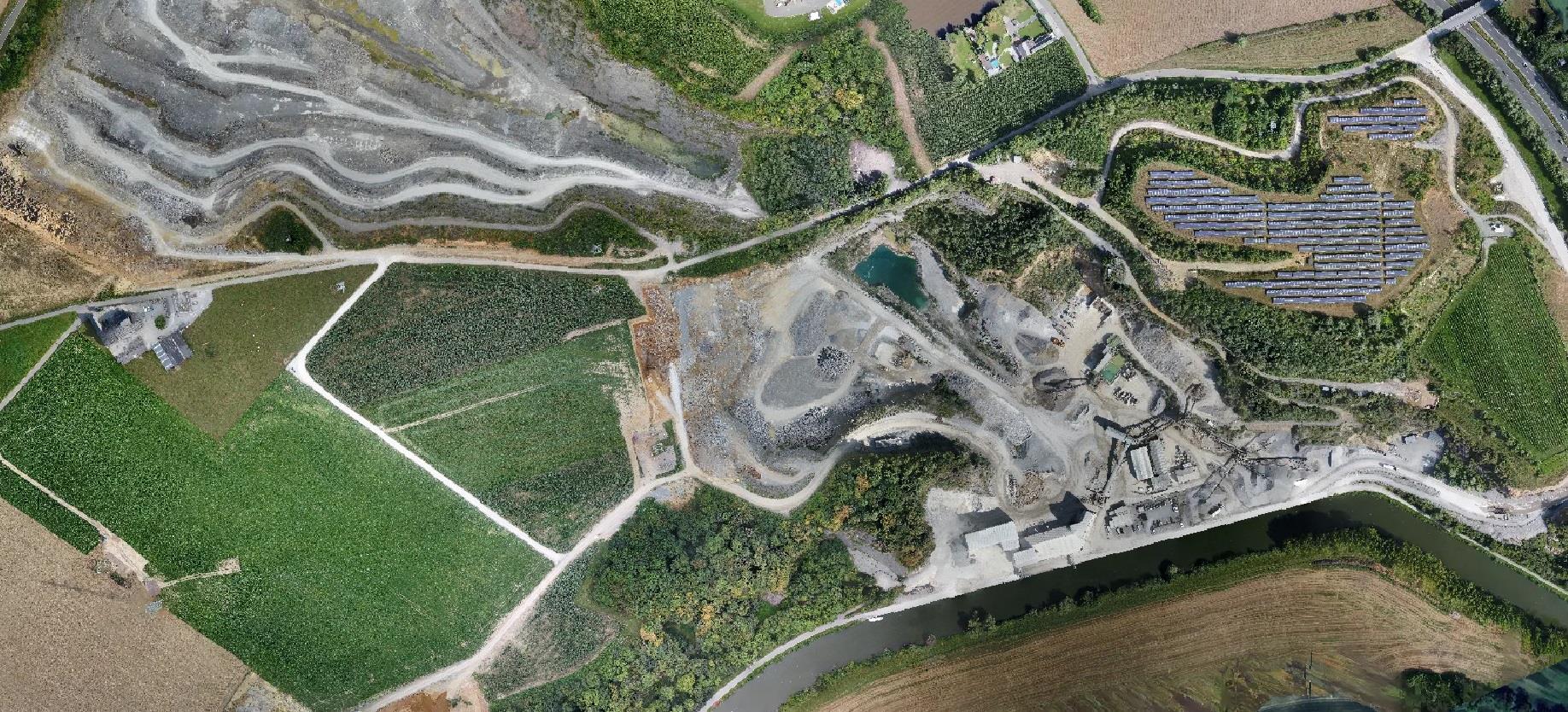
For this large-scale project, Droneview.be transformed an active 120-hectare mining site into a highly accurate digital terrain model. Where traditional surveying on this scale takes weeks, our drone data delivers a complete overview for efficient stockpile management and site monitoring within days.
The Challenge: Efficiency and Safety in Complex Environments
In a dynamic work environment like a quarry, safety is a priority. The client sought a method to collect accurate data without halting operational activities. Key requirements included:
- A high-resolution baseline measurement of the entire topography.
- Calculation of stockpile volumes with minimal margin of error.
- Accessible data for project managers without the need for heavy CAD software.
Technical Workflow: Photogrammetry at Scale
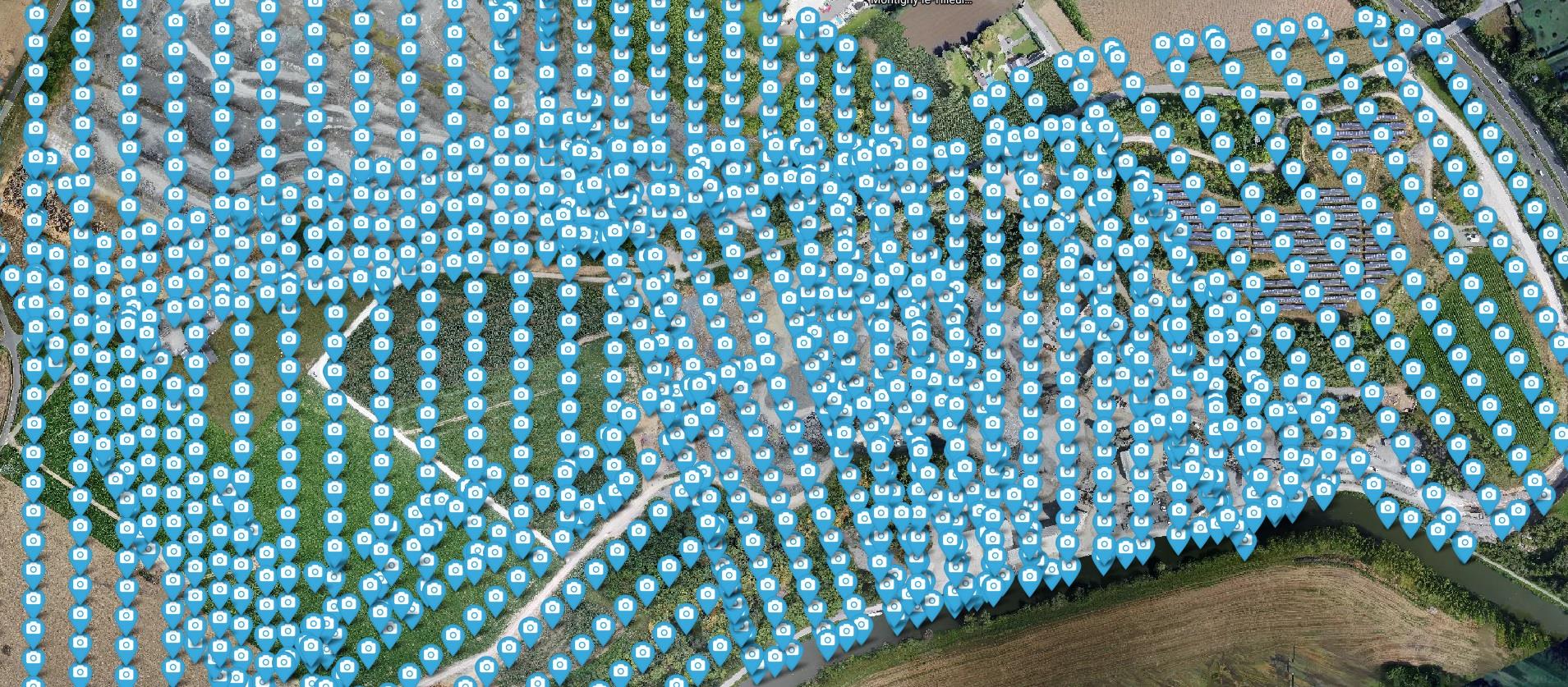
Data acquisition was carried out via pre-programmed flight paths, ensuring consistent overlap and GSD (Ground Sample Distance).
- Data Scope: Processing 1,750 RAW images for maximum clarity.
- Processing: Advanced reconstruction via the WebODM engine for a reliable point cloud model.
- Deliverables: Georeferenced orthophotos, Digital Surface Models (DSM), and Terrain Models (DTM).
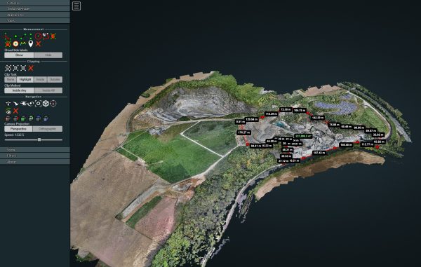
Interactive Analysis & Visualization
By converting the massive dataset into an interactive 3D environment, the client can calculate distances, areas, and volumes in the browser at any time.
👉 Launch the interactive 3D viewer of the quarry
Need help? Check out our WebODM Viewer Manual.
Project Details (Terrain Analysis)
| Feature | Specification |
| Surface Area | 120 Hectares |
| Capture Count | 1,750 High-Res photos |
| Technology | 3D Photogrammetry (WebODM) |
| Output | Orthophoto, DTM, DSM & 3D Mesh |