

Project EGEON: Thermal Digital Twin for BREEAM Certification
For the EGEON project, Droneview.be conducted an advanced thermal drone inspection. The objective was not merely to capture images, but to create a complete Digital Twin based on radiometric data. This report served as technical substantiation for the building’s BREEAM certification file.
The Challenge: Detecting Invisible Heat Loss
For large-scale buildings like this one, manually tracing insulation anomalies and thermal bridges is an impossible task. The client required a system that:
- Detects thermal deviations at great heights and on hard-to-reach facades.
- Directly localizes data spatially within a 3D model.
- Provides absolute temperature measurements for technical validation.
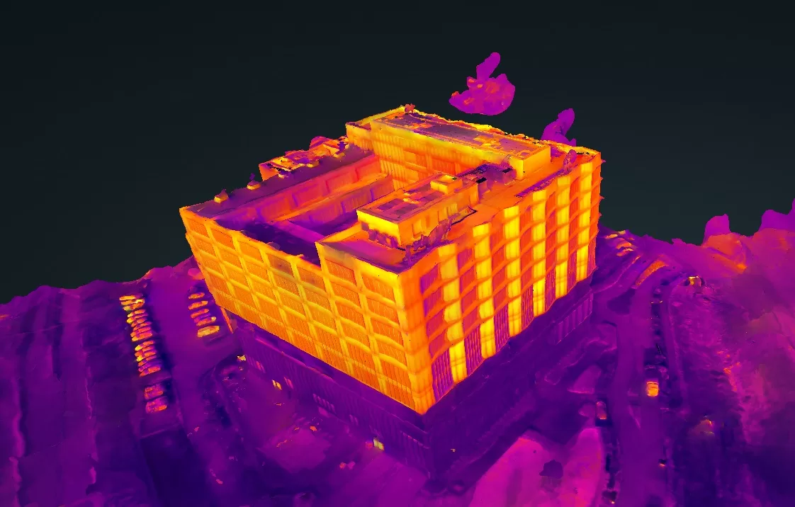
Our Methodology: Radiometric 3D Mapping
Using the DJI M30T, we performed a combined flight (thermal + visual).
- Dataset: 1,321 captures processed into a point cloud of over 20 million measurement points.
- Resolution: A razor-sharp visual GSD of 2.49 cm/px and a thermal GSD of 9.24 cm/px.
- Validation: Use of the Ironbow palette and DJI Thermal Tool v3 for absolute temperature measurements at an emissivity of 0.95 (bitumen/concrete).

Interactive Digital Twin & Reports
In this project, we go beyond a static report. We deliver an interactive environment where every pixel contains data.
👉 Interactive 2D Inspection Map (Orthomosaic)
👉 Open the Thermal 3D Digital Twin
Technical Project Details
| Parameter | Specification |
| Inspection Type | Thermography & 3D Digital Twin |
| Software | WebODM & LGT Engine 4.1.8 |
| Reconstruction | 20,359,244 3D measurement points |