
Exclusive for clients
Drone Inspection Portal: Your 3D Data & Projects Online
No more hassle with large files or slow downloads. At Droneview.be, you get access to a secure, interactive portal where all your drone inspections, measurements, and 3D models are centrally available.
From raw images to actionable insights
For the professional construction and industrial sectors, a photo alone is often not enough. You need measurable data and context. That is why we deliver every project in a customized online environment, accessible via any browser.
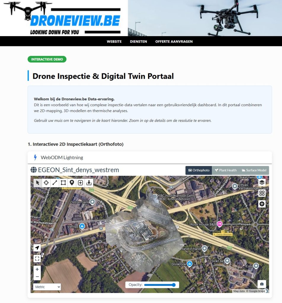
Interactive 3D Viewer
Navigate through point clouds and mesh models directly in your browser. Accurately measure distances, volumes, and heights without installing heavy software.
Thermal Analysis
View solar inspections down to the cell level. Effortlessly switch between visual and thermal views to locate hotspots and defects directly in the cloud.
Central Data Management
All your historical flight data and orthophotos in one place. Compare different capture dates to monitor the progress of your construction project flawlessly.
Technical Specifications & Integration:
- ✓ Geodata: Export to Orthomosaic (GeoTIFF), Point Clouds (.LAS, .LAZ), 3D models (.OBJ, .DXF)
- ✓ Software Integration: Fully compatible with BIM software, AutoCAD, Civil 3D, and ArcGIS.
- ✓ Security: Your data is stored on secure European servers (GDPR-compliant).
Ready for a more efficient workflow?
Curious how your next project will look in our portal?
Get a free quote for your project today.
🔒 Secure environment • 📊 Directly measurable data • ☁️ No installation required