Concern and Misunderstanding: How Illegal Drones Obstruct Professional Work

In recent weeks, drones have once again dominated the news. Illegal flights over military zones and even Brussels Airport (Zaventem) led to airspace closures. Understandably, both government and citizens are on high alert. Unfortunately, the consequences of these illegal flights are deeply affecting our legitimate operations. For professional drone pilots like us at DroneView.be, it’s becoming increasingly difficult to work safely and undisturbed.

When a Professional is Suddenly Seen as a Threat

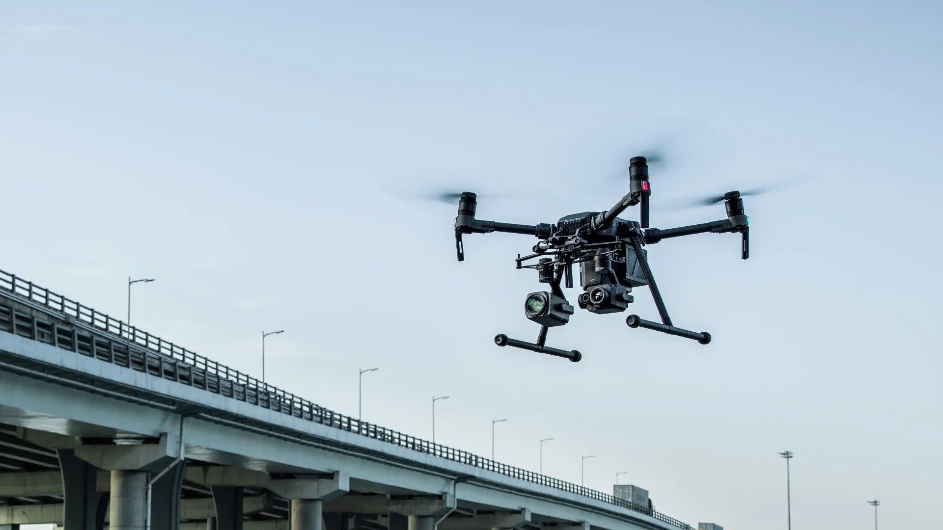
We carry out essential daily inspections of rooftops, buildings, and solar panels—detecting thermal anomalies with precision equipment. All flights are performed legally under EU open category rules, at low altitude, and only under safe weather conditions.

Still, we often encounter public suspicion. Just days ago, during a rooftop inspection, someone shouted “I’ll shoot that drone out of the sky!”—despite our hi-vis vests, clearly marked van, and low, legal flight at 20 meters with a thermal camera. No privacy invasion, no dangerous flying—just professional work. And yet, the police were called.
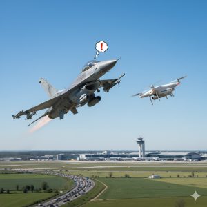
Relax F-16, it’s just DroneView.be at work

Communication Starts with the Client

We always try to inform authorities properly: registration ready, pre-flight police notifications (especially during current tensions), clear signage on-site. But we’ve found that things run smoother when the client also informs nearby residents. A quick notice can prevent unnecessary panic or hostility.


Strict Rules… with a Small Breakthrough

Continue reading “Concern and Misunderstanding: How Illegal Drones Obstruct Professional Work”
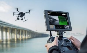
DJI under fire in the U.S. – what does it mean for Europe and Belgium?

The U.S. government is stepping up pressure on Chinese tech companies, and drone manufacturer DJI is increasingly in the spotlight. Several legislative proposals and investigations could lead to a partial ban on DJI drones in the United States.
But what does this mean for the rest of the world – and especially for Europe and Belgium? Will prices rise, deliveries slow down, or models disappear?

DJI logo


1. What’s happening in the United States?

In July 2025, the U.S. Department of Commerce launched a national security investigation into Chinese drones, including those made by DJI.
The new U.S. defense budget law also requires DJI to pass an audit before the end of 2025; otherwise, the company could be placed on the “FCC Covered List”, preventing certification and import of new models.
Consumers haven’t yet noticed much change, but manufacturers and distributors are already preparing for possible restrictions.


2. Why this matters for DJI

Continue reading “DJI under fire in the U.S. – what does it mean for Europe and Belgium?”

Stricter drone control in Europe – How to check where you can fly in Belgium

Illegal drones are increasingly being detected

In recent weeks, drones have been spotted at sensitive locations across several European countries – from airports to energy infrastructures. In some cases, fingers were pointed towards Russia, although this remains unconfirmed.
What is clear is that governments are taking these incidents seriously. In Belgium too, drone surveillance is being tightened, especially near airports, military zones, ports, and border areas. In risk zones, authorities can now detect, intercept, or even disable drones more quickly.


What does this mean for regular drone pilots?

For both recreational and professional pilots, the rules remain the same — as long as you are properly registered and operate within the allowed zones.
However, it is now more important than ever to check before each flight whether you are allowed to fly and to request authorisation in time when operating in controlled or risk areas.


Step-by-step: how to check where you can fly in Belgium

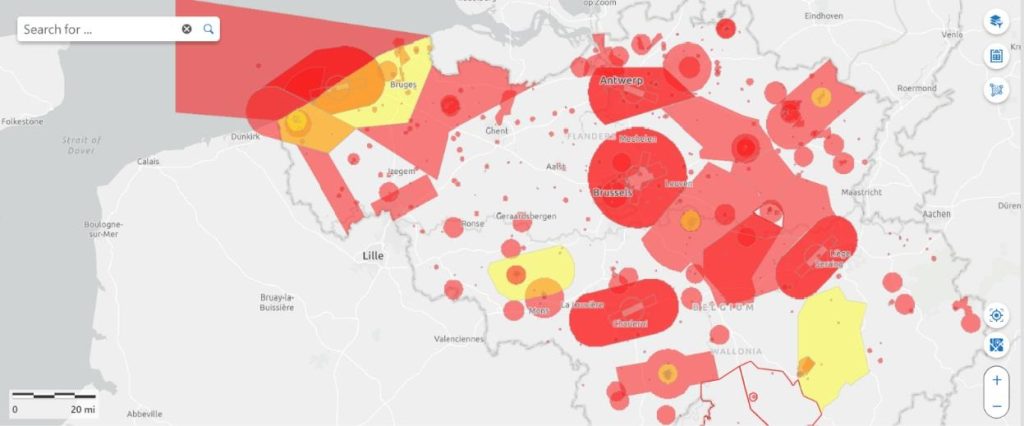
1. Use the official Belgian drone map

Go to https://map.droneguide.be
This interactive map shows at a glance:

  • Green zones: free to fly under the Open category
  • Orange zones: specific conditions apply (altitude limits or prior authorisation)
  • Red zones: restricted or prohibited areas (CTR, military sites, nuclear plants…)

You can select either Open category or Specific category at the top, depending on your certification.

DroneGuide map


2. Check temporary restrictions (NOTAMs)

Some areas may be temporarily restricted for events, state visits, or military exercises.
Always check the NOTAMs via the
skeyes AIM-METEO briefing.
Alternatively, use
EAD Basic (EUROCONTROL) – free registration required.
If you need to operate in a controlled or military zone, submit your request via the
DAA planner.

Continue reading “Stricter drone control in Europe – How to check where you can fly in Belgium”

When a Drone Federation Goes Silent – Our Experience with the Belgian Drone Federation

At DroneView.be, we strongly believe in collaboration within the Belgian drone sector. Professional pilots, training centers, insurers, and authorities all benefit from clear communication and united representation.
In early 2025, we decided to join the Belgian Drone Federation (BDF), convinced that an active federation could help move the sector forward.

Six months later, we regret to conclude that the federation appears to have gone completely silent.

Belgian Drone Federation


What Membership Should Offer

According to the BDF’s official website, an annual membership of €199 (excl. VAT) should include:

  • Representation and advocacy for the drone sector
  • Networking with fellow professionals and entrepreneurs
  • Four newsletters per year
  • Free access to webinars
  • Discounts on BDF events and Van Dessel drone insurance
  • First-line advice on Open A1/A3, Open A2 & Specific categories
  • Company listing on the BDF website
  • Invitations to PRO events and roundtable sessions

On paper, a solid offer for professional drone operators.


The Reality

Unfortunately, the reality is quite different.
Since joining in March 2025, we have only received an automatic payment confirmation — no newsletters, no invitations, no updates, no communication at all.
After several attempts to reach out — via email, social media, and directly to board members — we received no reply. Even simple questions went unanswered.

After six months, it seems clear that the federation has ceased to operate actively.

Continue reading “When a Drone Federation Goes Silent – Our Experience with the Belgian Drone Federation”

Remote ID Beacon: the digital license plate for your drone

Introduction

More and more drone pilots hear the term Remote ID, but few know exactly what it means. Since 2024, a Remote ID beacon has become essential: a small module that acts as the digital license plate of your drone. In this article we explain how such a beacon works and why it is also the solution for older drones.


What is a Remote ID beacon?

A Remote ID beacon is a lightweight transmitter that you easily attach to your drone. The device continuously broadcasts important data via Bluetooth, such as:

  • your operator ID (the official registration number of the pilot),
  • the position and altitude of the drone,
  • the position of the pilot.

This allows anyone with the right app or scanner to immediately see who is flying and where.


How does it work in practice?

The beacon is completely stand-alone:

  • it has a built-in GPS antenna to determine its position,
  • a built-in rechargeable battery (lasting 8–16 hours) that you recharge via USB-C,
  • a simple mounting system with Velcro or tape so you can attach it to almost any drone.

You don’t need to modify your drone: the beacon does all the work itself.


Example: the Dronetag Beacon

One of the most popular models is the Dronetag Beacon:

  • weight: only 16 grams,
  • battery life: up to 16 hours,
  • user-friendly: settings via an app on your smartphone,
  • compliant with EU standards, fully legally approved.

Thanks to the built-in GNSS receiver you don’t need extra antennas or cabling.

Dronetag beacon


Continue reading “Remote ID Beacon: the digital license plate for your drone”

Why Older Solar Panel Installations Are at Risk – and How Thermal Imaging Makes a Difference

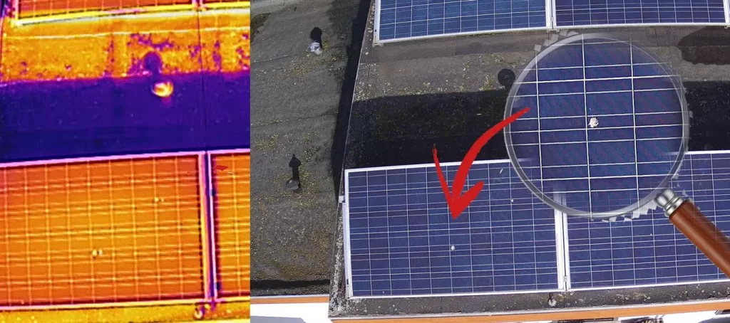
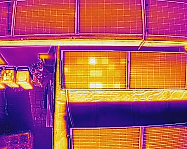
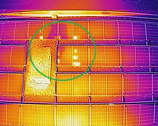
Solar panels are built to last, but that doesn’t mean they keep performing at their best. Especially older installations (10+ years) are more likely to suffer from hidden defects, reduced output, or even safety issues. A thermal drone inspection offers a fast and safe way to detect these problems.

Older panels: weak or missing bypass diodes

Modern solar panels come with bypass diodes that help redirect current around faulty cells or zones. But older panels — often pre-2010 — don’t always have them, or they no longer function properly.

  • Some panels have no bypass diodes at all.

  • Others have cheap or damaged diodes after years of use.

  • Some were poorly designed, so the diode doesn’t activate as it should.

Continue reading “Why Older Solar Panel Installations Are at Risk – and How Thermal Imaging Makes a Difference”

Clear communication in every drone flight – DroneView.be

When we operate our drones on-site, the focus often goes straight to the technology: the cameras, the flight planning, and the images we capture. But just as important is the way we communicate – with clients, bystanders, and the environment. Clear communication prevents misunderstandings, builds trust, and ensures that a drone flight runs smoothly and safely.

Preparation: clarity from the start

Before carrying out a flight, we coordinate precisely with the client on the objectives and our approach. That may sound obvious, but this clarity also helps during execution: everyone knows what will happen, and why. When bystanders ask questions, we can immediately refer to the concrete assignment.

Working visibly and recognizably

Continue reading “Clear communication in every drone flight – DroneView.be”

FPV Drones: DIY, Technology, and the Future

15 years ago: my first steps as a drone builder

Fifteen years ago, I started as an enthusiastic hobbyist building my own FPV drone. I personally milled lightweight carbon frames on a small CNC machine and assembled all components: a basic camera, a video transmitter, and small electric motors. With an FPV headset on my head, I flew – still quite inexperienced – across the landscape, seeing the world as if I were flying myself. That first self-built drone experience gave me an incredible thrill and laid the foundation for my passion for FPV drones.

What are FPV drones?

FPV stands for First Person View and means that, as a drone pilot, you receive live images directly from the drone’s camera. In the early days, this usually happened via an analog video link, with a small transmitter on the drone and a receiver built into the goggles or monitor. This way, you experience the flight as if you are inside the drone – something drone enthusiasts describe as a unique, almost bird-like sensation. Although technology has advanced enormously since then, the core feeling remains the same: flying in real time through the eyes of your aircraft.

Continue reading “FPV Drones: DIY, Technology, and the Future”

The DJI Zenmuse XT2: Thermal and Visual Power for Drone Inspections

At Droneview.be, we combine advanced technology with real-world experience. For thermal drone inspections, we use the DJI Zenmuse XT2—a unique camera that captures thermal and visual images simultaneously. Ideal for situations where temperature differences provide critical information, such as with solar panels, roofs, or industrial installations.

What makes the Zenmuse XT2 so special?

The XT2 is more than a regular thermal camera. This dual-sensor camera combines a FLIR thermal sensor with a 4K RGB camera, allowing immediate correlation of heat data with sharp visuals. For our professional drone service, this means significant time savings and unmatched accuracy.

Key benefits of the DJI XT2

  • Quick problem detection: Heat loss, defective solar panels, electrical overloads, or moisture issues become visible in a single flight.

  • Safe and efficient inspections: No need for physical access to buildings, roofs, or equipment—everything is done remotely.

  • Time-saving: We combine thermal and visual data in one flight, making analysis faster and more effective.

Continue reading “The DJI Zenmuse XT2: Thermal and Visual Power for Drone Inspections”

“Make Drones Great Again?” – What if Trump Launches a Drone Next?

Red, White & Drone: Is the Trump Drone Really on Its Way?

In a world where marketing often speaks louder than technology, something curious just took off in the American media landscape: the Trump Phone. Yes, the president (or at least his sons) launched their own smartphone—complete with a mobile network. And while the tech world was choking on its coffee, we at Droneview.be couldn’t help but wonder: is a Trump Drone next?

The Trump Phone: Patriotism in a Chinese Package

First, claim that American companies are too powerful. Then attack the competition. And finally launch your own “Made in the USA” smartphone… which turns out to be made in China. Welcome to the Trump Phone: an overpriced Android device drenched in patriotic flair and marketing that promises more than it delivers.

Until you dig a little deeper,..

Continue reading ““Make Drones Great Again?” – What if Trump Launches a Drone Next?”