
What Can You Do with WebODM?
At DroneView.be, we see every day how powerful drone imagery can be — not only for creating impressive photos, but especially for delivering practical insights. Thanks to WebODM, we can turn raw aerial photos into clear maps, 3D models, and measurable data. This opens the door to applications across many sectors: from real estate and construction to agriculture and technical inspections. In this article, you’ll discover how versatile drone mapping really is, and where you can use it.
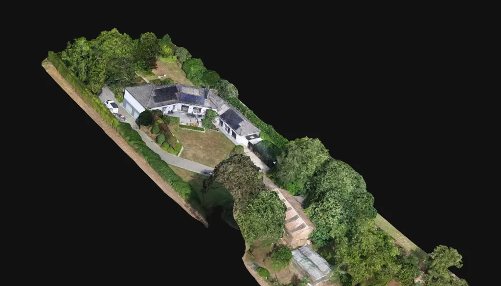
3D Scans and Virtual Tours for Real Estate
Selling a property goes faster and easier when you present it visually in an attractive way. With WebODM we can:
- create a 3D scan of a house or apartment
- set up a virtual tour of a property so buyers can explore online
- generate floor plans and measurements from aerial images
For real estate agents and developers this is a huge asset: it saves time, provides a clearer picture, and makes a property much more appealing online.
Keywords: 3D house scan, virtual home tour, selling property with drones
Construction Site and Project Monitoring
Every phase matters in a construction project. With a drone flight and WebODM, we can map the site perfectly:
- 3D models of construction projects for contractors and clients
- clear progress reports you can compare over time
- aerial photos of the site useful from every angle
This way, you don’t always have to be on-site to check progress — the drone images tell the story.
Keywords: drone construction site, 3D scan construction project, drone site monitoring
Inspections of Roofs, Buildings, and Solar Panels
Where ladders and scaffolding used to be required, a drone now does the job. With WebODM you can process the photos into useful results:
- Drone roof inspection without safety risks for staff
- Facade inspections for cracks, wear, or moisture issues
- Solar panel inspection with thermal images: defective or overheated panels become immediately visible
The results are not only faster, but also safer and often cheaper than traditional methods.
Keywords: drone roof inspection, solar panel inspection drone, drone facade inspection
Agriculture and Crop Monitoring
WebODM also proves its value in agriculture. With drone images you can:
- get a complete overview of fields and crops
- see where problems arise from drought, disease, or pests
- make quicker decisions about irrigation or fertilization
A drone gives a perspective you can never have from the ground. With WebODM, you turn those images into clear information that farmers can use immediately.
Keywords: drone agriculture, crop monitoring drone, agricultural drone imagery
Calculating Volumes and Surfaces
With a drone and WebODM, you can quickly make calculations that would otherwise take hours:
- Calculate volumes of sand, gravel, or stockpiles
- Measure surfaces and elevation differences for projects or quotes
- Terrain measurements for contractors and quarries
Everything is based on aerial images, with no physical measuring required. This saves time while still providing accurate results.
Keywords: drone volume calculation, drone surface measurement, drone stockpile measurement
Conclusion
WebODM is more than software: it is a tool that converts drone images into data you can use immediately.
Whether it’s a 3D house scan, project monitoring, inspections, or agricultural applications — the possibilities are extensive and highly practical.
Want to know more? Check out our earlier tutorials: