Technical Drone Inspections for Industrial and Construction Projects
Droneview.be supports construction companies, energy operators and property managers with thermal inspections, 3D mapping and advanced drone data analysis.
We deliver verifiable data that supports critical project decisions.
Certified operations in compliance with Belgian drone regulations. Clear reporting with measurable results.
Why your site manager is wasting 80% of their time on measurements
Traditional surveying is slow and often dangerous. While your team is manually setting out points, you are losing valuable hours. With DroneView.be technology, you measure volumes from 300 m³ to 100 million m³ in seconds, directly in your browser.
- No software required: Access via the cloud on PC, tablet, or smartphone.
- Irrefutable evidence: Prevent disputes over earthworks with 3D visibility.
- Extreme scalability: From small excavation pits to quarries 117m deep.
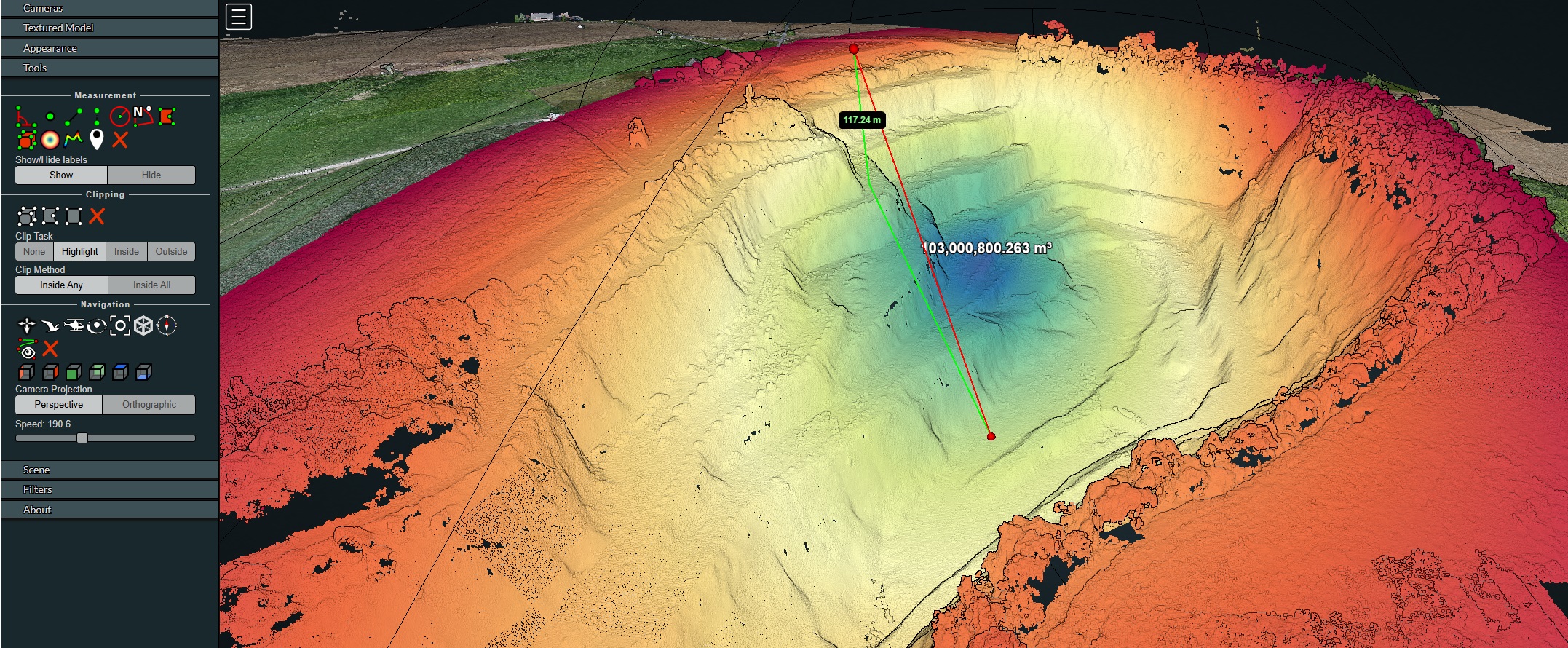
Experience the Power of the Digital Twin Want to see the detail of our drone surveys for yourself? Try our interactive 3D demo and discover how to calculate volumes and manage your site with a single click. No complex software needed.
Who We Work For
- Construction and infrastructure companies
- Project developers
- Industrial property managers
- Energy companies and PV operators
- Engineering firms and technical consultants
- Private clients requiring specialized inspections or 3D scans of their property or land.
Data-Driven Inspection and Analysis
Our drone solutions are developed for professional applications where accuracy, safety and efficiency are critical.
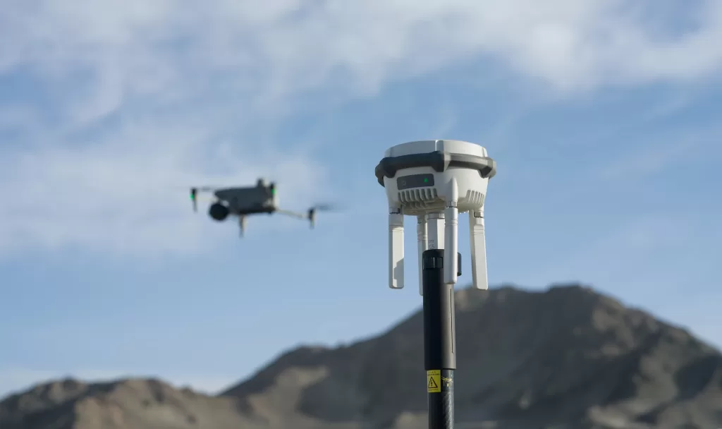
High-Precision Positioning with RTK Technology
For projects requiring centimeter-level accuracy, Droneview.be operates its own RTK base station. Using the D-RTK 3 Multifunctional Station, we provide survey-grade precision for 3D mapping, volumetric calculations and technical inspections.
This system corrects satellite data in real time and ensures stable positioning, even in complex environments such as industrial sites, urban areas or locations with signal reflections.
Result: measurable data with maximum reliability, suitable for professional reporting, construction site monitoring and technical decision-making.
Earthworks & Survey Preparation
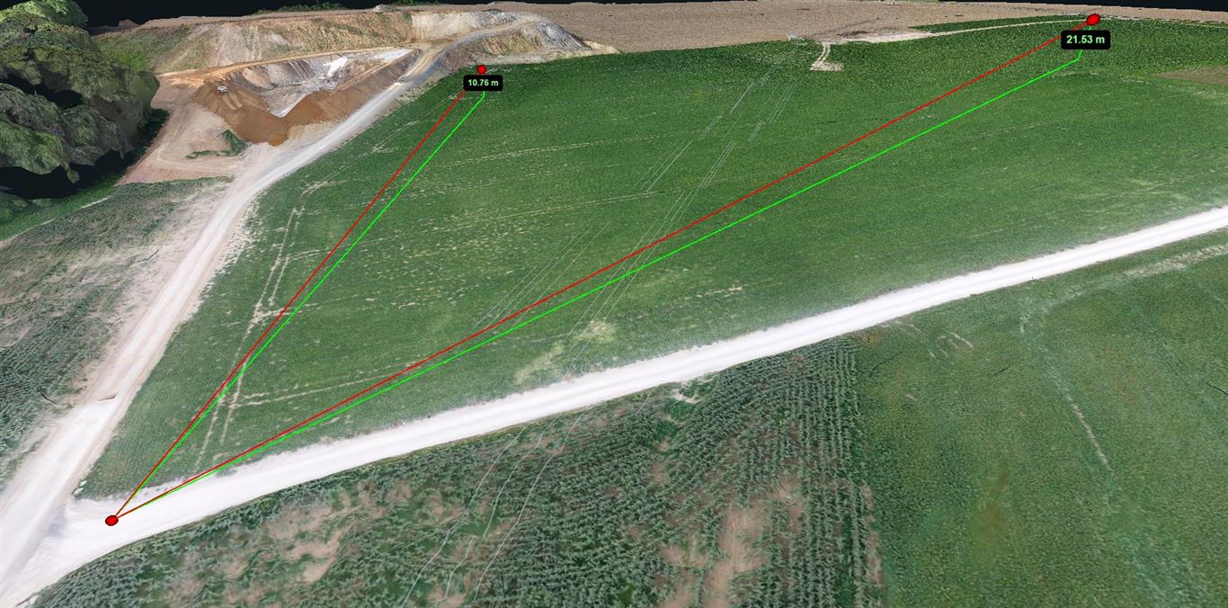
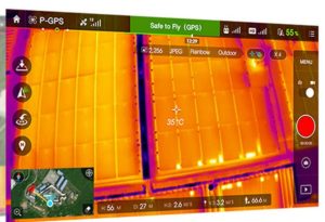
Fast Site Measurements for Earthworks and Quotations
Significantly reduce the turnaround time of your project quotations. With our drone surveys, you can complete full survey preparation directly from your office. Instead of spending half a day physically on-site, you measure elevation differences and distances with centimeter-level accuracy directly in your browser.
-
No software installation required: Work directly in the secure cloud environment we provide.
-
Efficient cost estimation: Ideal for calculating earthworks measurements, excavation volumes and grading projects.
-
Instant results: Determine slope gradients and point-to-point distances (as in the example: 10.76m and 21.53m elevation difference) in just a few clicks.
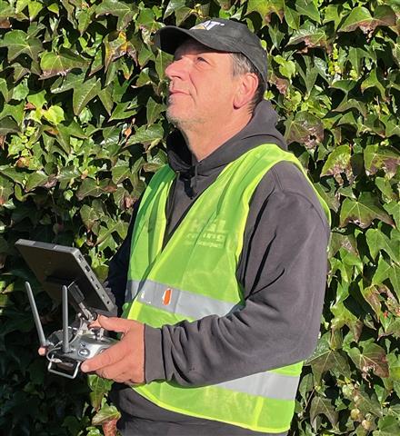
Thirty years in the mud, now with a view from above.
“Having spent 30 years as an independent contractor in earthworks, I know better than anyone that a site stands or falls on the accuracy of its numbers. I spent years with a measuring rod in my hand, experiencing the endless discussions over cubic volumes. Although drone technology wasn’t around during my time as a contractor, I now use today’s precision to solve the problems I used to face. I don’t sell photos; I deliver the data I wish I’d had back then to work more efficiently and safely.”
— Guy Liebert, CEO DroneView
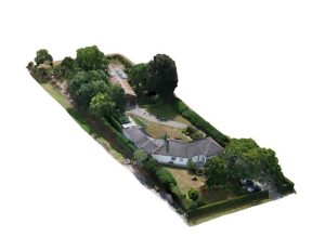
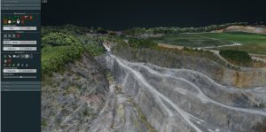
3D Scanning, Mapping and Volume Calculations
Digital terrain models, orthomosaics and volumetric analysis for construction monitoring, excavation projects, stockpile management and project control. All models are accessible online through our WebODM platform.
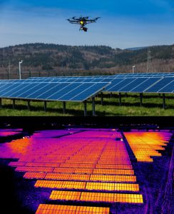
Thermal Inspection of Solar Panels
Detection of hotspots, string failures and performance loss in industrial PV installations and solar farms. Analysis without production downtime and with clear priority reporting.
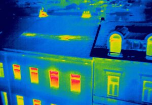
Thermal Building Inspection and Technical Audits
Identification of heat loss, thermal bridges and moisture intrusion in industrial buildings, logistics facilities and large real estate projects. Suitable for technical audits and renovation planning.
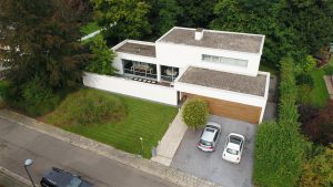
Project Visualization and Aerial Photography
Construction progress documentation, marketing visuals and visual support for reporting or communication.
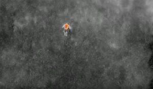
Search & Rescue Support
Real-time thermal imaging and high-zoom visuals to support professional search operations.
Why Large-Scale Projects Choose Droneview.be
- Measurable and reproducible data.
- Suitable for technical reporting and internal project control.
- Operations compliant with Belgian drone legislation, using professional-grade equipment.
- No scaffolding, no lifting platforms, minimal operational disruption.
- Time and cost savings
- Certified drone data for BREEAM support, EPC audits, and industrial inspections.
“Save up to 80% time on preliminary site measurements for quotations. Our digital terrain models eliminate the need for physical site visits for standard dimensioning.”
Our Projects Speak for Themselves
Examples from Flanders and Wallonia.
Inspection of 500 Solar Panels
12 defective panels detected in less than 2 hours.
3D Mapping of Quarry Site
1,750 images processed into a measurable 3D model.
What Our Clients Say
“Thanks to Droneview, we detected defective panels before the maintenance team arrived. The investment paid for itself immediately.” – Energy company, Limburg
“Their 3D models save us hours of fieldwork during quotation preparation. We now measure elevation differences and volumes accurately from our desks, making our earthworks pricing faster and error-free.” – Contractor, Antwerp
Schedule a Technical Analysis
We are happy to explore how thermal inspections or 3D drone surveys can make your project more efficient and data-driven.
Discuss Your Project
Email Us Directly
Limburg, Belgium