Introduction: The Power of Drone Mapping
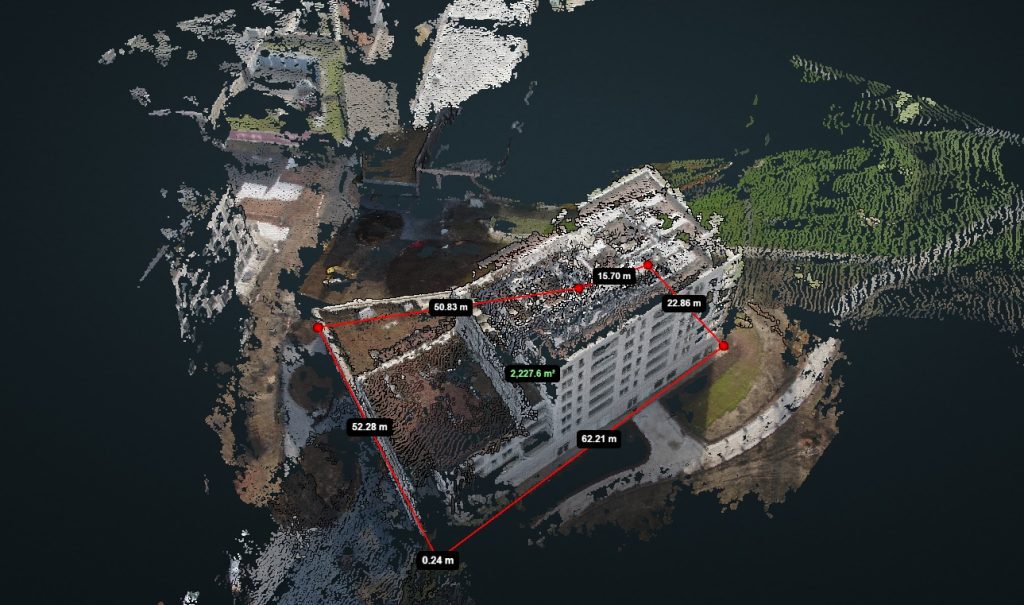
At DroneView.be, we do more than capture spectacular aerial photos. We transform drone imagery into measurable, actionable data for our clients. Traditional inspections and land surveys, especially across vast areas like quarries, are time-consuming, risky, and often inaccurate. Our recent project in a quarry perfectly illustrates how drone mapping streamlines this process. From 1,750 individual photos, we created an interactive 3D model, enabling the client to easily perform volume calculations and efficiently manage the site.
Case Study: Precision in the Quarry
The Project: Our client, a quarry operator, needed an accurate, up-to-date overview for material management and strategic planning. Covering more than 100 hectares, manual surveying was impossible. DroneView.be conducted a series of automated drone flights, resulting in a dataset of 1,750 images.
Our Approach: Mission Flights
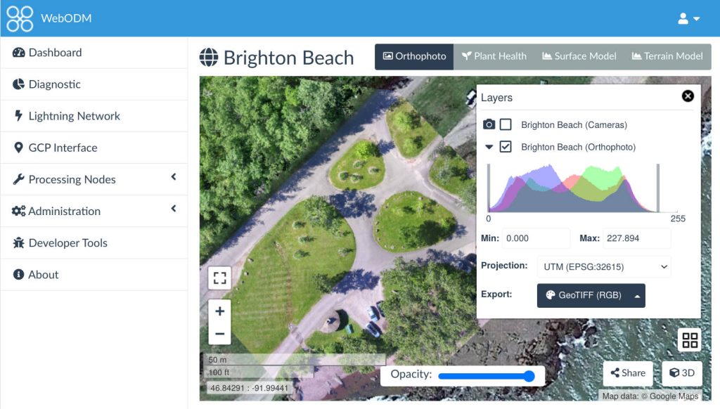
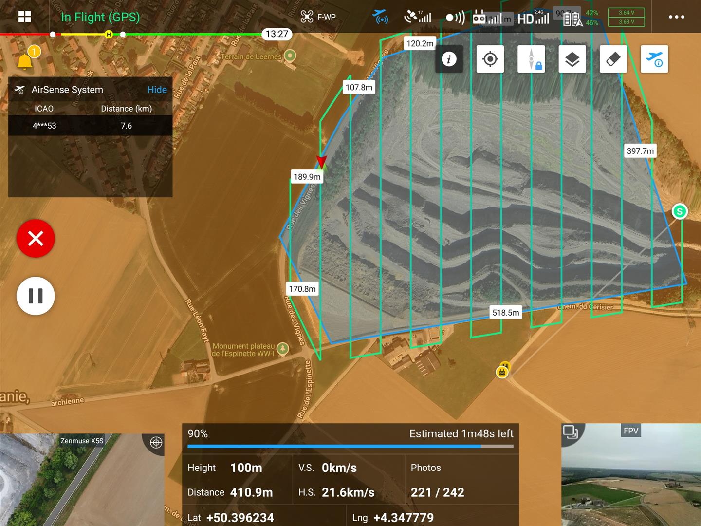
For a site of this size, preparation is crucial. We plan about ten mission flights, partly from the office and partly on-site. Each flight is carefully configured to systematically capture the entire area with proper overlap. The structured pattern ensures that all images can later be seamlessly processed into one complete 3D model in WebODM.
Continue reading “From 1,750 Drone Images to 3D: How Drone Mapping is Revolutionizing Mining”