
In the fast-evolving world of real estate, standing still is not an option.
Potential buyers and tenants expect more than static photos and descriptions.
They want to get a realistic sense of a property before scheduling an in-person viewing.
3D real estate scans offer exactly that.
At DroneView.be, we use this technology to elevate property presentations to a higher level. This article explains how 3D scans work, what advantages they offer, and why they are quickly becoming the new standard in real estate marketing.
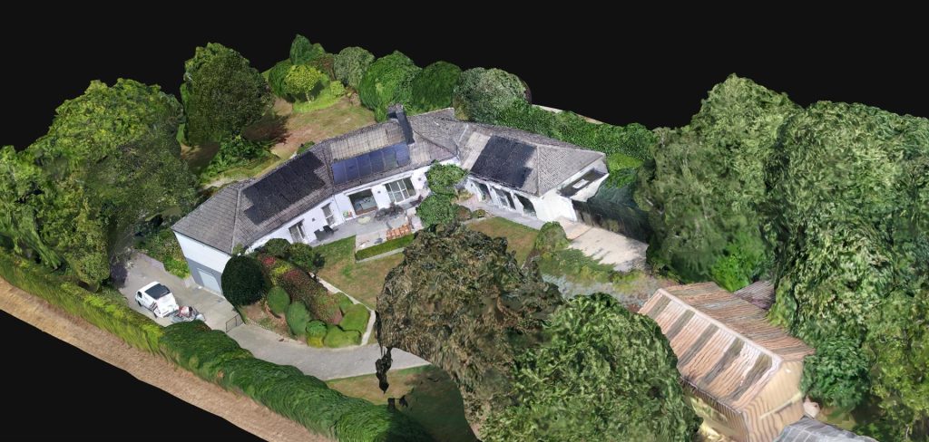
What is a 3D Visualisation of a Property?
A 3D visualisation is a virtual model of an existing building, created by capturing dozens to hundreds of aerial and façade images. These images are processed using specialised software such as WebODM to generate an accurate and detailed 3D model. The result is a digital twin of the property that provides far more insight than traditional media.
The visualisation consists of two key components:
- 2D orthophoto: A scale-accurate top-down image of the property and its surroundings, offering a clear view of the layout and dimensions.
- 3D model: An interactive representation that visitors can rotate, zoom and explore on any device, providing a 360° virtual tour directly from your own website.
Continue reading “3D Real Estate Scans – The New Standard in Property Presentations”