
Why your site manager is wasting 80% of their time on measurements (and how to change that).
The invisible costs of traditional measuring
Many construction sites still rely on measuring poles and manual spreadsheets. While this may feel “familiar,” it carries hidden costs:
- Valuable time: Your site manager is a coordinator, not a full-time surveyor. Every minute spent in the mud is a minute not spent on planning or quality control.
- Invoicing disputes: Discrepancies in earthwork estimates often lead to delays in final settlements.
- Safety risks: Manually measuring on active sites or unstable stockpiles introduces unnecessary risks.
The Solution: Drone-Powered Data Management
DroneView.be transforms your site into a Digital Twin. We fly over the location and quickly deliver a complete digital copy where you can perform everything that previously required a physical presence.
Unlimited Scalability: From Foundation Pit to Quarry
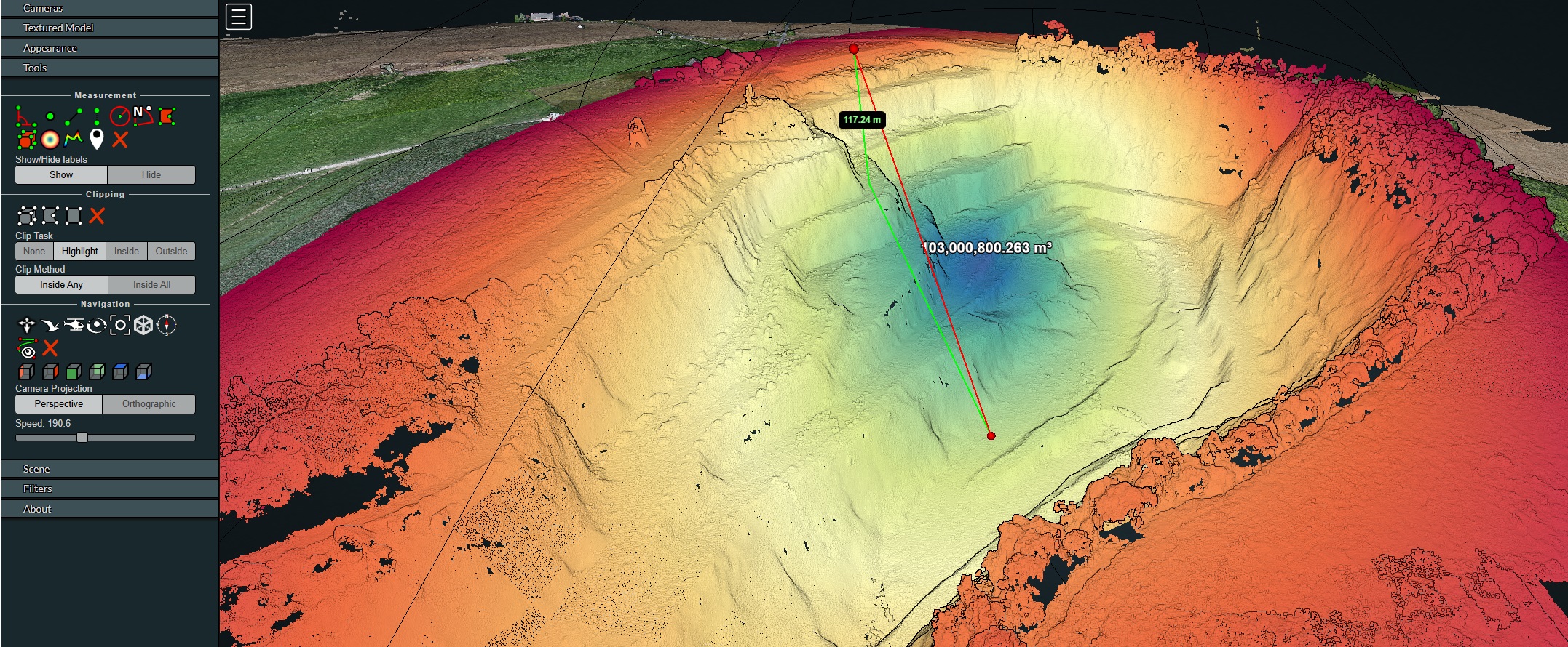
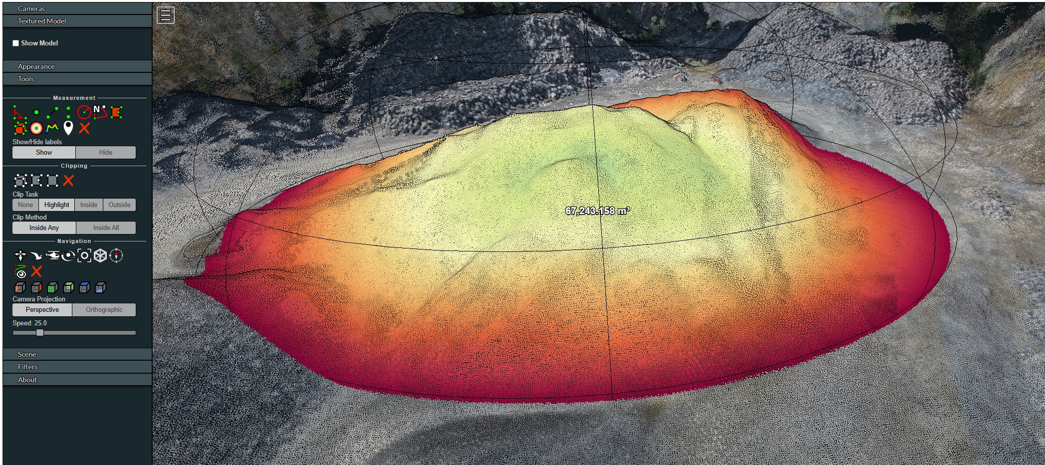
The power of digital data is that the complexity remains the same for the user, regardless of project size. Whether we measure a residential cellar excavation (300 m³) or a massive quarry of 103 million m³ and 117m deep (as shown above): the calculation in our cloud environment happens in mere seconds.
Weeks of work vs. a single mouse click
Imagine if the quarry above had to be measured manually by a surveyor with a total station or GPS pole. We would no longer be talking about hours or days, but weeks of intensive and risky field work.
With DroneView.be technology, we push the boundaries:
- No terrain is too large: Our drones capture millions of data points while the rest of the site continues to operate.
- Instant results: Once the data is processed, you can perform the most complex volume calculations with the click of a button.
- Safety first: No one needs to descend into deep pits or balance on dangerous edges to obtain an accurate measurement.
“The question is no longer whether you need a measurement, but how many weeks of labor costs and time you are willing to lose to traditional methods.”
What changes for your team?
- Measurements in seconds, not hours: Volume and distance calculations happen with a few clicks in our cloud environment.
- Decide based on facts: Thanks to centimeter-accurate RTK data, there is no more room for interpretation. What you measure is the reality.
- Access anywhere (No software needed): Your site manager on-site, the estimator at the office, and management at home all look at the same up-to-date data via their web browser.
How we make the difference
| Traditional Method | DroneView Digital Approach |
| Hours of manual point collection | Full site scan in < 30 min |
| Dangerous climbing on stockpiles | Safe remote measurement |
| Static paper reports | Interactive 3D cloud environment |
| Post-project volume disputes | Irrefutable visual evidence |
Ready to step into the digital construction site?
Want to see exactly how much time your team can save? View an interactive demo project directly in your browser and test for yourself how easily you can measure volumes and distances.
Stop estimating, start measuring. Bring your site management into the 21st century.
Experience for yourself how to calculate volumes in a model of millions of data points with just a few clicks. Request a demo link