Drone Services in Belgium – Aerial Photography & Inspections
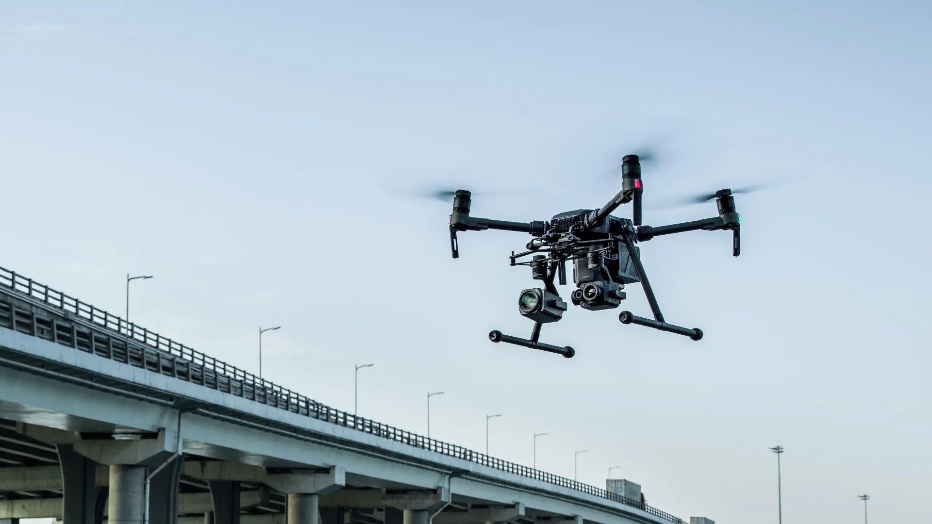
At Droneview.be, we offer professional drone services across Belgium. Whether you need aerial photography, thermal imaging, or technical inspections, our expert team provides high-quality drone solutions using state-of-the-art technology like the Zenmuse XT2 and Zenmuse Z30 cameras.
Drone Service in Your Area
Looking for drone services in Belgium? We operate in various cities, including examples of travel expenses:
-
Brussels – Real estate photography, construction monitoring (travel cost: €40)
-
Waterloo – Roof inspections, infrastructure surveys (travel cost: €45)
-
Mons – Industrial site inspections, security monitoring (travel cost: €74)
-
Wavre – Agricultural analysis, thermal imaging (travel cost: €35)
-
Tervuren – Drone mapping, environmental monitoring (travel cost: €33)
-
Rixensart – Wind turbine and solar panel inspections (travel cost: €42)
Travel costs are calculated at €0.60/km. Need drone services in another region? Contact us for a custom quote!
1. Drone Photography & Aerial Videos
Our drones capture sharp aerial photos and videos, ideal for real estate presentations, construction projects, events, and landscape photography. With the Zenmuse Z30, we can zoom in on even the smallest details, providing a complete view of any project. For thermal analysis, we utilize the Zenmuse XT2.
2. Thermal Inspection of Solar Panels
Our thermal drone inspections detect issues such as faulty cells or overheating panels. Using the Zenmuse XT2, we capture temperature differences in solar panels, allowing us to recommend optimizations to improve the system’s efficiency.
3. Insulation Loss & Heat Loss Inspection
A well-insulated building is essential for energy efficiency. Our drones equipped with the Zenmuse XT2 can detect heat loss by measuring temperature differences, helping to identify insulation problems and leading to significant energy savings.
4. Construction Inspections & Project Documentation
We provide extensive drone inspections for construction projects, capturing both overview images and detailed close-ups with the Zenmuse Z30. This allows for precise tracking of construction progress and early identification of any issues.
5. Search and Rescue
At Droneview.be, we support search and rescue operations with our specialized drones. Using the Zenmuse XT2 thermal camera, we can detect heat sources, even in low-visibility conditions like forests or at night. The Zenmuse Z30 zoom camera allows us to focus on hazardous areas without taking risks, offering precise assistance during searches.
Our services are designed to assist ground teams by quickly and efficiently scanning large areas. While we are not investigators or rescue experts, our aerial technology serves as a crucial tool to optimize the search process and improve success rates.
6. 3D Scans and Advanced Analysis
At DroneView.be, we transform drone imagery into interactive 3D models and precise analyses. Gain a complete overview of your site, from quarries and construction areas to heritage sites and agricultural projects. Our technology enables accurate volume calculations, problem detection, and helps you plan and manage your projects more efficiently.
7. WebODM tutorial: get the most out of your 2D and 3D models
In addition to our drone services, we also deliver measurable data you can use yourself. With WebODM, you get access to interactive 2D and 3D models of your project. We created a clear tutorial that guides you step by step on how to view camera positions, perform measurements, and calculate volumes.
Discover the full tutorial here
8. Real Estate 3D Scans for Property Agencies
At DroneView.be, we combine traditional real estate photography with interactive 3D models of properties.
We provide both the high-resolution photos for your real estate website and the additional aerial images required for the 3D reconstruction.
The 3D models are published on a dedicated webpage, and you receive a link that you can easily embed on your own website.
Read more about our Real Estate 3D Scan service
Why Choose Droneview.be?
- Advanced Technology: We use drones equipped with Zenmuse XT2 for thermal imaging and Zenmuse Z30 for precision zoom shots.
- Safe and Efficient: Our drones easily reach inaccessible places like roofs, tall buildings, and vast agricultural fields.
- Expert Team: With years of experience in drone and thermal technology, we deliver high-quality results for both individuals and businesses.
- Live Monitoring During the Flight:
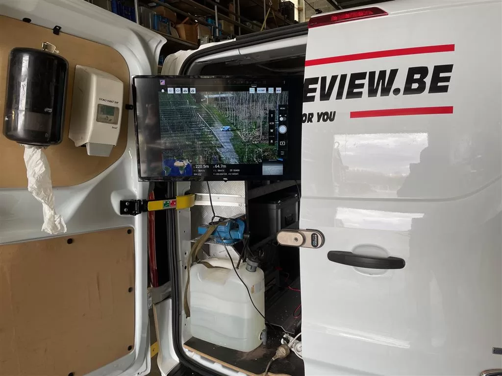
To serve our clients even better, we now offer the possibility to watch live on an external 32” monitor. This allows you to follow the footage in real-time as we conduct the drone flight. It not only ensures greater transparency but also makes it easier to make quick decisions or provide guidance during inspections or search operations.

Looking for a professional drone service in Belgium? Contact us today for more information or a custom quote!
Contact us today for personalized advice or a free quote.
