If you fly drones, you’ll eventually deal with geo-zones — defined areas in the airspace where flying is restricted. What many drone pilots don’t know: in 2024, DJI loosened its geofencing system. In this article, we explain what geo-zones are, how they work in Belgium, and what’s changed in DJI’s Fly app.
What Are Geo-Zones?
Geo-zones are areas where drone flights are limited to ensure the safety of airports, military sites, and populated zones. Some are completely restricted, others require authorization or additional precautions.
In Belgium, these zones are defined by national aviation authorities and published on platforms like Droneguide.be. DJI integrates these restrictions into its drones via a geofencing system.
Types of Geo-Zones in Belgium:
-
-
No Fly Zones – flight strictly forbidden
-
Restricted Areas – flight only allowed with prior approval
-
Warning Areas – no restrictions, but extra caution required
-
CTR Zones (Controlled Traffic Regions) – around airports; authorization required
-
Temporary Restrictions (NOTAMs) – during events, emergencies, etc.
-
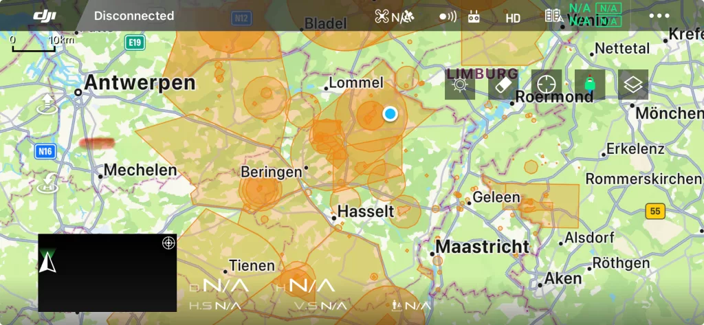
What’s New in 2024: DJI Relaxes Geofencing
DJI drones no longer block flights in certain areas. Many zones once labeled “No Fly” are now “Enhanced Warning Zones.” That means you’ll get a warning in the DJI Fly app, but not an automatic lockout. Responsibility now lies with the pilot.
Example: Kleine-Brogel Military Base
This area used to be completely red (no take-off). Now, it appears orange in the DJI Fly app — a clear sign of DJI’s relaxed approach. Still, pilots remain fully responsible and must verify legality via Droneguide.be.
⚠️ Important: DJI Maps Are Not Legally Binding
Even if DJI allows takeoff, Belgian law still applies. Red zones on Droneguide.be remain restricted. You may only fly with official permission from authorities like Skeyes or the DGLV. DJI’s system does not override national regulations.
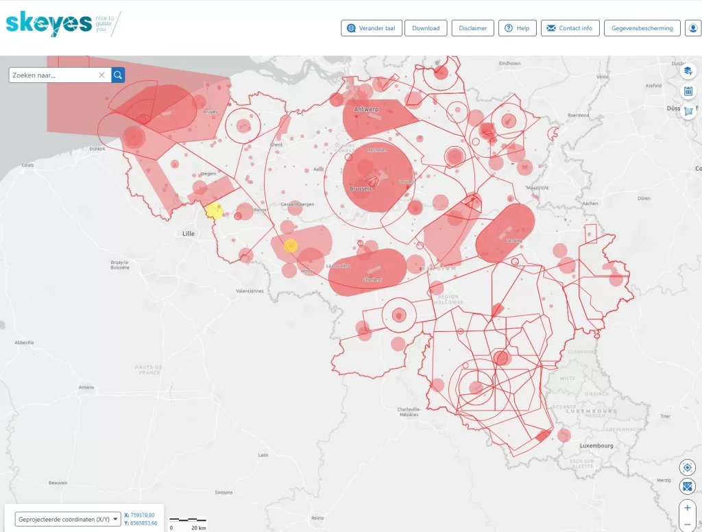
Where to Check Legal Geo-Zones in Belgium?
-
Droneguide.be – official Belgian airspace map
-
DJI Fly or DJI Pilot app – live warnings and zone alerts
-
DSA (Digital Sky Application) – for filing flight authorizations
-
Géoportail or SkyDemon – more detailed flight data
Can Professionals Fly in Restricted Zones?
Yes, but only after submitting a request and receiving approval. At Droneview.be, we regularly apply for permits and follow strict planning procedures involving:
-
Exact coordinates and time slots
-
Max altitude
-
Risk analysis and safety protocol
-
Air traffic coordination (if needed)
What Are the Risks of Unauthorized Flights?
-
Fines and drone confiscation
-
Loss of insurance coverage
-
Legal prosecution
-
Reputation damage
Tips for Drone Operators:
-
Always check Droneguide.be before flying
-
Don’t rely solely on DJI’s take-off permission
-
Submit authorization requests early
-
Work with certified professionals when in doubt
Fly Safely and Legally – Let Droneview.be Handle It
We know what’s allowed — and what’s not. From applying for authorizations to flying near airports or complex zones, Droneview.be ensures your drone operations are 100% legal and safe.
Want to know more? Contact us today.