
Do you have a drone without RTK, but want to create 3D models and maps that are accurate to the centimeter? Droneview.be helps you with the foundation of every high-quality mapping project: measuring Ground Control Points (GCPs).
Not every drone pilot has expensive GNSS equipment or an RTK drone. Yet, precision is essential for professional photogrammetry, volume measurements, or site surveys. We come to your location and set out the necessary reference points for you, so you can focus on the flying.
Why choose our GCP Service?
Without Ground Control Points, a drone map can deviate by meters from reality. By using our points, you anchor your project to the real world.
-
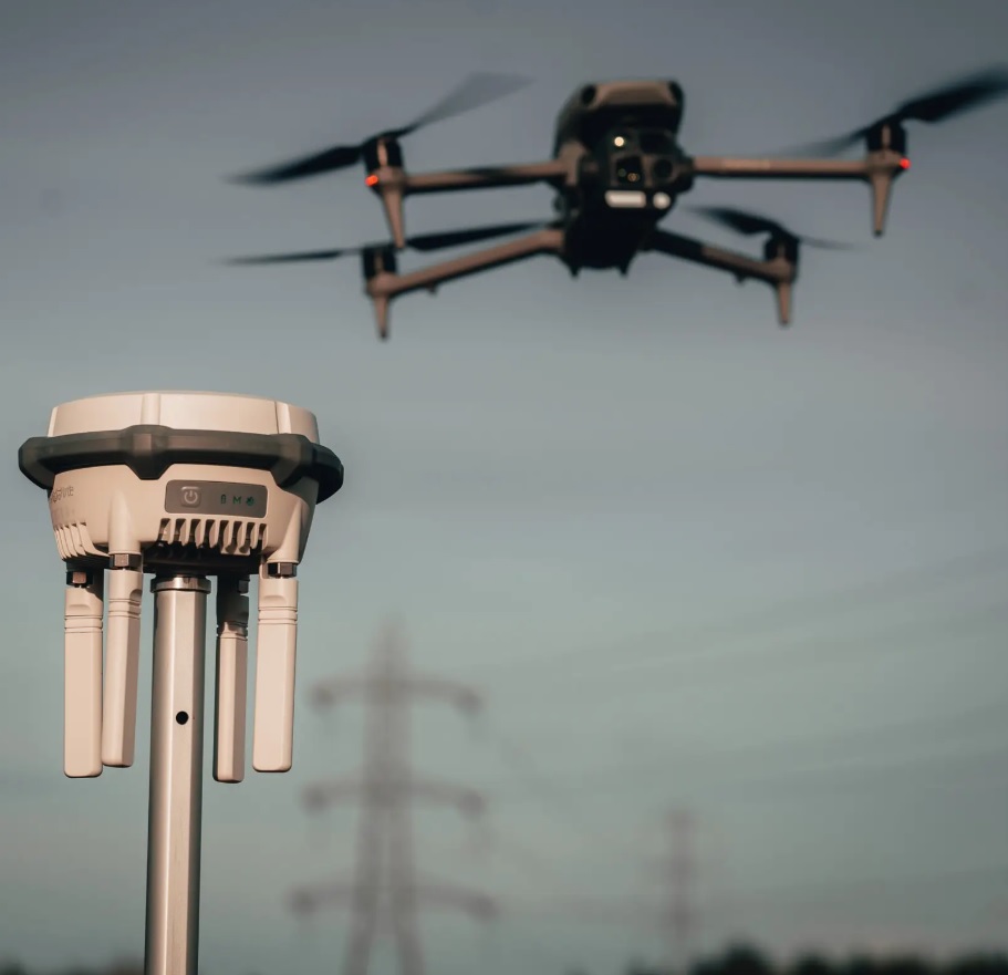
Centimeter Accuracy: We measure using the professional DJI RTK High-Precision GNSS system (RTK correction).
-
Ready to Use: You will receive a clear CSV or Excel file (Lambert 72 / TAW) that you can import directly into software such as Pix4D, Agisoft Metashape, Webodm, or DJI Terra.
-
Cost-efficient: No heavy investment needed in your own surveying equipment for occasional assignments.
Our Packages & Rates
We use transparent pricing so you know exactly what to expect upfront.
| Service | Number of Points | Price (excl. VAT) |
| GCP Start | 1 to 5 points | € 150,- |
| GCP Pro | 6 to 10 points | € 250,- |
| Custom Work | > 10 points | On request |
-
Travel Expenses: € 0.6 per kilometer driven from Duras (Sint-Truiden)
-
Marking: Points are marked by default with biodegradable marking paint (high visibility from the air) or
Option: Physical Targets
Would you prefer to work with our professional black/white targets instead of paint? That’s possible!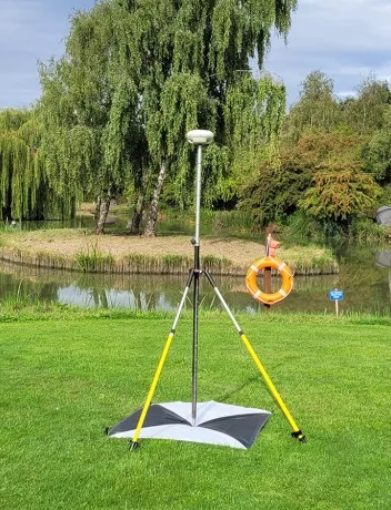
-
We place the targets for you on-site.
-
Deposit: € 250,- (immediately refunded once targets are returned in good condition).
How do we work?
-
Request: You provide us with the location and the boundaries of the area to be mapped.
-
Placement: We arrive on-site before your flight and strategically measure the points for the best results.
-
Flight: You perform the drone flight. The points are clearly visible in your photos.
-
Data Delivery: Within 24 hours after the measurement, you will receive the coordinates list digitally.
Droneview Tip: For optimal results, we recommend using at least 5 points (4 on the corners and 1 in the center of your area).
Ready for an accurate measurement?
Turn your drone photos into reliable survey data. Contact us to schedule a date or for a custom quote for larger projects.
No time or equipment to fly yourself?
Leave the entire project to us.
Would you prefer a turnkey result without worrying about technology, flight planning, or data processing? Droneview.be specializes in full mapping projects. We handle everything: from legal flight applications and GCP measurement to delivering a high-res orthophoto or 3D model.