
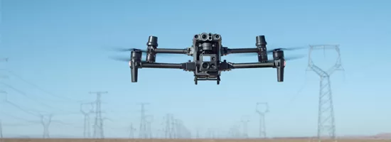
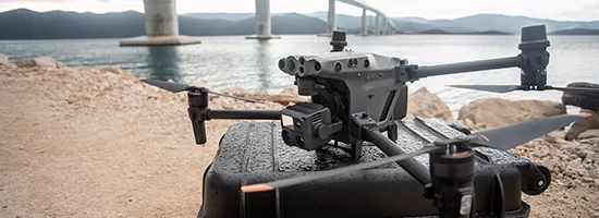
With the deployment of the DJI Matrice 30T, Droneview.be strengthens its services in professional drone inspections, surveying support and data-driven site monitoring.
This drone is not a traditional upgrade, but an integrated measurement platform combining inspection, mapping, thermography and distance measurement in one robust system.
For construction projects, property developers and architects where every centimeter matters, this technology makes a measurable difference.
For complex projects where every centimeter counts, the M30T truly makes the difference.
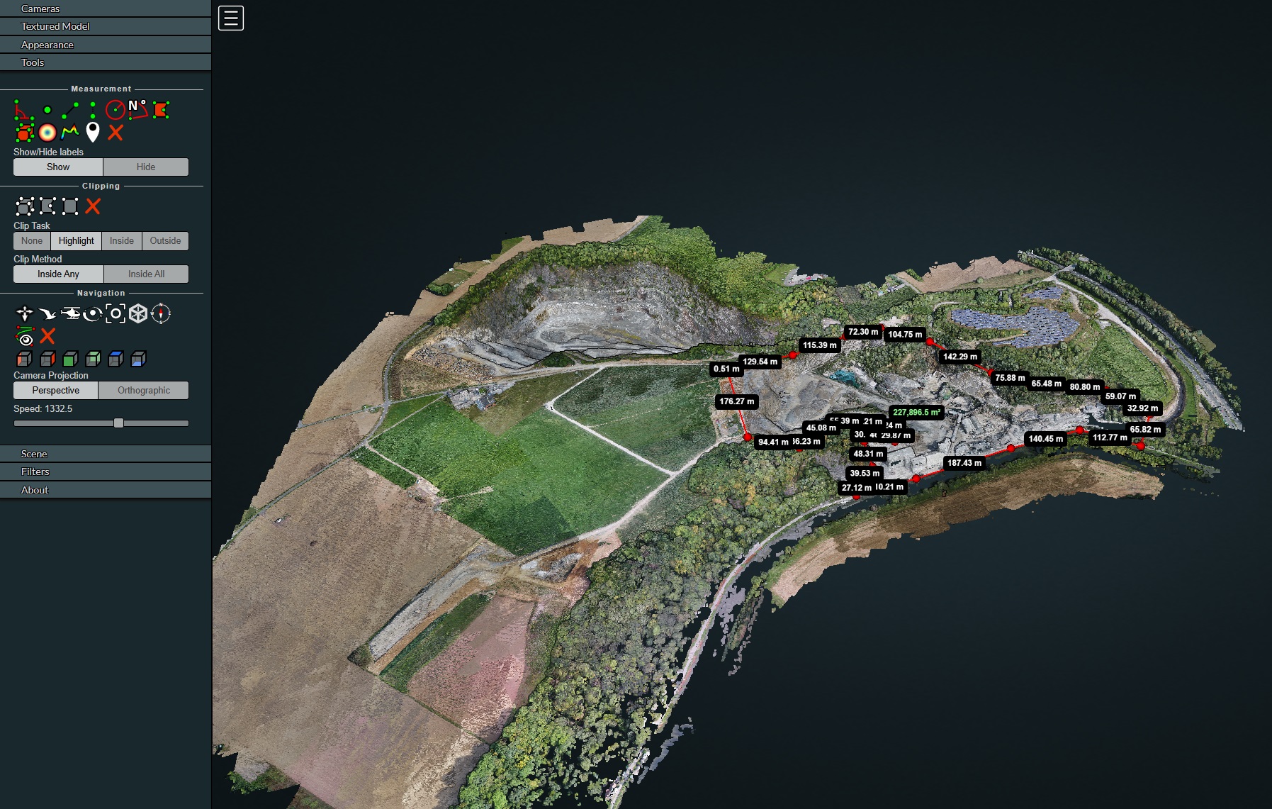
Centimeter-level mapping accuracy thanks to our own RTK station and FLEPOS
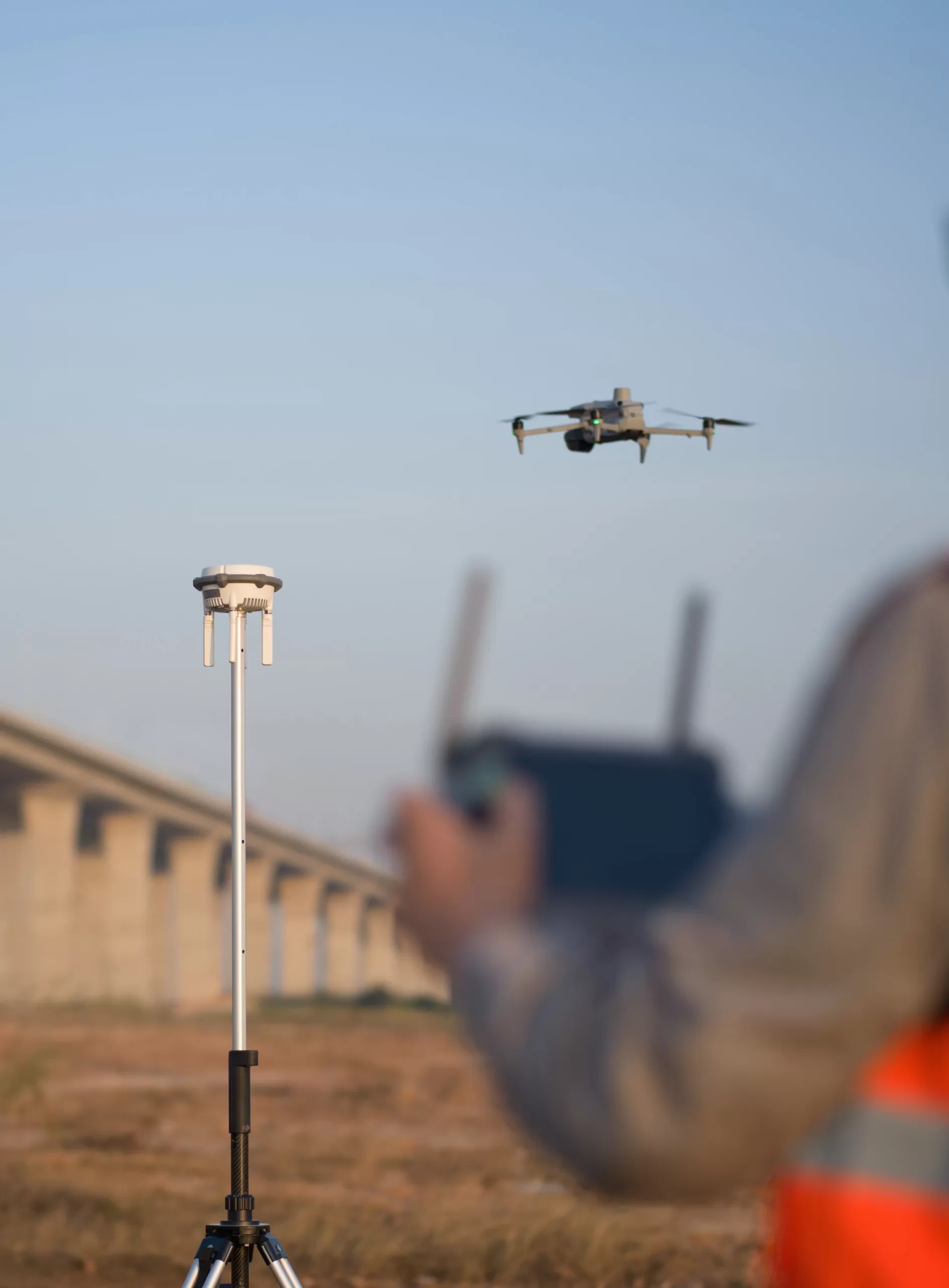
The M30T features built-in RTK (Real-Time Kinematic). For maximum accuracy, Droneview.be operates with a professional in-house RTK base station, connected to the Belgian FLEPOS reference network.
This combination allows us to achieve positioning accuracy of 1 to 3 centimeters, fully compliant with surveying standards.
Using our own RTK station means:
- Independent and stable correction signals
- Reliable operation in areas with limited network coverage
- Consistent measurement quality across multiple projects
- Reproducible datasets for periodic measurements
- This translates concretely into:
- Setting out and verifying earthworks
- Volume calculations of excavations and storage areas
- Parcel analysis for subdivisions and developments
- Digital Elevation Models (DEM) for drainage and sewer studies
- 3D terrain models for architectural integration
- As-built verification and comparison with design plans
Engineering firms and architects receive reproducible measurement data directly usable for further engineering.
Thanks to RTK support, the number of ground control points is reduced, speeding up site acquisition and improving processing efficiency.
RTK applications beyond drone flights
Our RTK base station is not exclusively used for drone flights. The system can also be deployed independently for precision positioning and ground-based surveying.
Possible applications:
- Surveying reference and control points (GCPs)
- Setting out building lines and axes
- Foundation height verification
- Positioning utilities and technical infrastructure
- Preparation of surveying documentation
- Support for subdivision and infrastructure projects
For developers, contractors and architects, this means one integrated measurement system can be used throughout all project phases: from design and earthworks to final delivery.
By combining aerial data and ground measurements, a coherent and verifiable measurement framework is created, significantly reducing discussions about heights, volumes or positioning.
Support for property development and architecture
For developers and architects, the M30T offers key advantages in both the design and execution phases:
Preliminary design & feasibility studies
- Detailed terrain analysis
- Contour lines and slope gradients
- Integration of buildings into existing topography
Execution phase
- Verification of staked foundations
- Earthmoving monitoring
- Design vs. construction comparison
Delivery phase
- As-built 3D models
- Documentation for technical files
This allows a large part of site verification to be carried out digitally and objectively, without permanent presence on site.
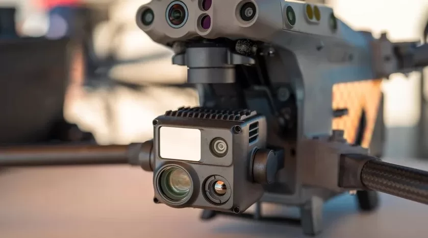
Triple-camera system: visual, thermal and zoom in one flight
What makes the M30T unique is the integration of multiple sensors in one compact payload.
During a single mission we automatically capture:
- Wide images
- Zoom images
- Thermal images
Wide Camera
- 12 MP
- 1/2” CMOS sensor
- Ideal for overview and mapping
Zoom Camera
- 48 MP
- 5x optical zoom
- Up to 16x hybrid zoom
- Up to 200x maximum digital zoom
For inspections of masts, wind turbines, facades or industrial installations, we remain at a safe distance while still analyzing microscopic details.
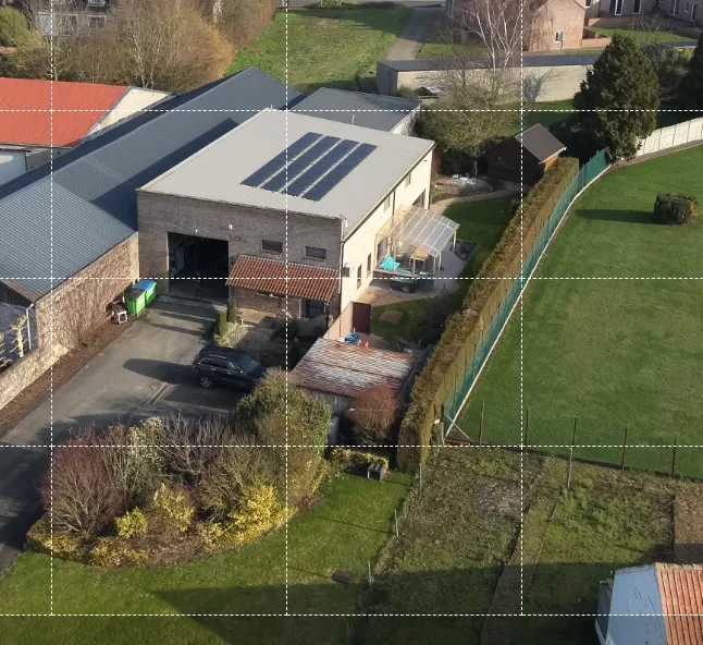
High-Res Grid: extreme resolution without risk
With the High-Res Grid function, the drone automatically scans a selected area and combines multiple 48 MP zoom images into one ultra-high-resolution image.
Result:
- Exceptional level of detail
- No risk from flying close to structures
- Ideal for facade inspections and technical analysis
In the office, images can be zoomed in to millimeter level without quality loss. (each frame in the example image becomes a new 48 MP detail image)
Thermal camera with radiometric data
The integrated thermal sensor delivers:
- 640 × 512 resolution
- Radiometric temperature data per pixel
- High measurement accuracy
Applications:
- Detection of defective solar panels
- Identification of heat loss
- Inspection of electrical installations
- Monitoring of industrial processes
- Environmental and wildlife monitoring
The combination of thermal and visual imagery in one flight significantly speeds up inspections.
Laser Rangefinder: measuring up to 1200 meters
The integrated laser rangefinder measures distances up to 1200 meters.
With one click we determine:
- Exact GPS coordinates
- Distance to the object
- Height differences
For hard-to-reach locations or rapid defect localization, this provides major efficiency gains.
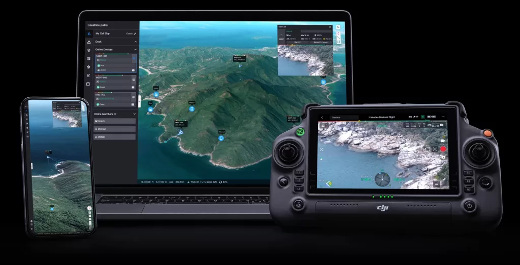
DJI FlightHub 2: planning and collaboration in real time
Via DJI FlightHub 2 we plan missions in advance in the cloud.
Advantages:
- Flight routes perfectly adapted to the environment
- Integration of existing maps into planning
- Remote live viewing
- Adding annotations during flight
This improves safety, speed and collaboration between site and office.
Uninterrupted operations thanks to dual hot-swap
Battery-related downtime is a thing of the past.
Drone
The M30T operates with a dual-battery system. Batteries are swapped one by one while the drone remains powered on. RTK fix and systems remain active.
Within approximately 30 seconds, we are airborne again.
Controller
The DJI RC Plus features both an internal and external battery. The external battery can be replaced during operation without interrupting the screen or connection.
This enables long-duration operations on large sites.
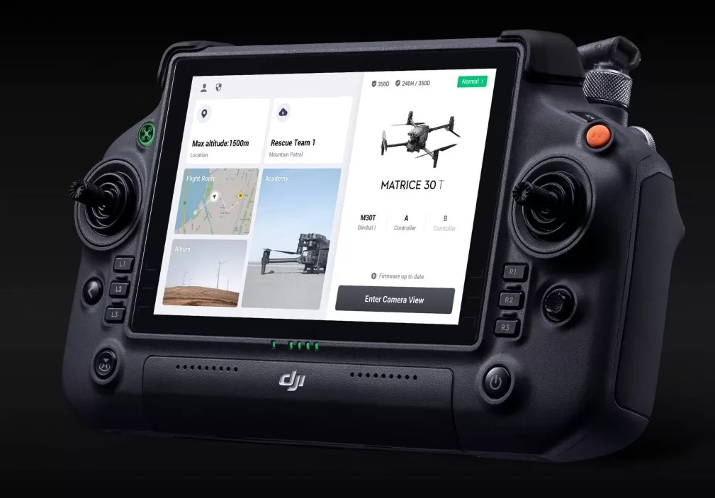
Advanced controller with HDMI output
The DJI RC Plus is a robust industrial controller with a large, bright display.
Important for our clients:
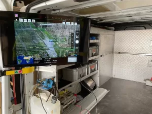
Through the HDMI output, we connect the controller directly to an external monitor.
At Droneview.be, we use a 32” monitor on site, allowing clients to follow inspections or mapping flights live. This ensures:
- Full transparency
- Immediate feedback
- Faster decision-making
Compact, rapidly deployable and robust
Compared to larger industrial drones, the M30T is:
- Compact and foldable
- Quickly operational
- Weather-resistant
- Ideal for multiple locations in one day
For urgent interventions or distributed projects, this is a major advantage.
Broadly deployable across multiple sectors
The combination of RTK, thermography, zoom and laser makes the M30T suitable for:
Construction & Infrastructure
Site monitoring, earthwork layout, volume calculations, structural inspections
Property Development & Architecture
Terrain analysis, integration, as-built documentation
Energy & Industry
Solar parks, technical installations, high-voltage components
Agriculture & Terrain Analysis
Parcel measurements, terrain modeling
Public Authorities & Property Management
Inspection of public infrastructure and buildings
Thermal monitoring of natural areas
What does this mean for your project?
With the DJI M30T we combine:
✔ Centimeter-level mapping precision
✔ Visual, thermal and zoom data in one flight
✔ Laser distance measurements up to 1200 meters
✔ High-resolution composite imagery
✔ Live monitoring via external display
✔ Minimal downtime thanks to hot-swap
The result: more data, less risk, faster reporting and more efficient project preparation.
The DJI M30T takes our services to the next level. Curious how this technology can benefit your site or installation?