What Can You Do with WebODM?
At DroneView.be, we see every day how powerful drone imagery can be — not only for creating impressive photos, but especially for delivering practical insights. Thanks to WebODM, we can turn raw aerial photos into clear maps, 3D models, and measurable data. This opens the door to applications across many sectors: from real estate and construction to agriculture and technical inspections. In this article, you’ll discover how versatile drone mapping really is, and where you can use it.
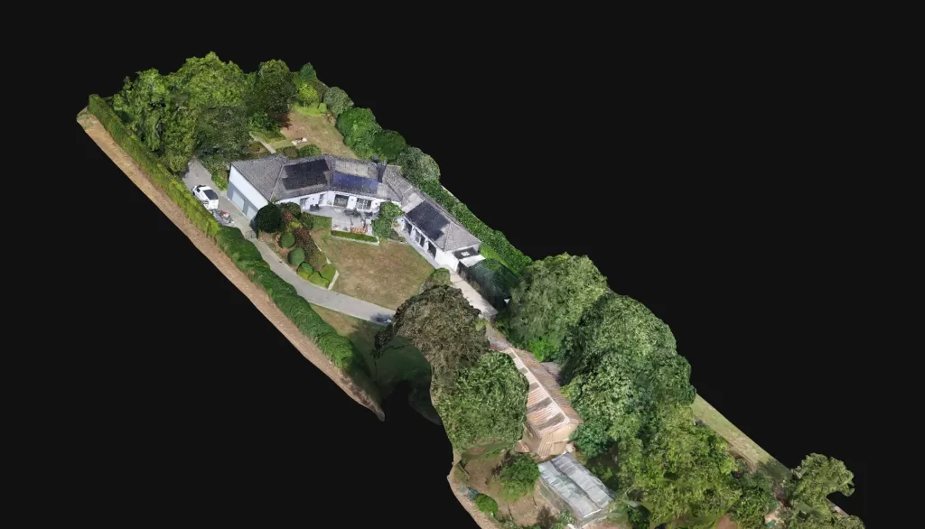
3D Scans and Virtual Tours for Real Estate
Selling a property goes faster and easier when you present it visually in an attractive way. With WebODM we can:
- create a 3D scan of a house or apartment
- set up a virtual tour of a property so buyers can explore online
- generate floor plans and measurements from aerial images
For real estate agents and developers this is a huge asset: it saves time, provides a clearer picture, and makes a property much more appealing online.
Keywords: 3D house scan, virtual home tour, selling property with drones
Continue reading “From 3D House Scans to Construction Monitoring and Inspections”