
Drone Services in Belgium – Aerial Inspection, Mapping & Construction Data
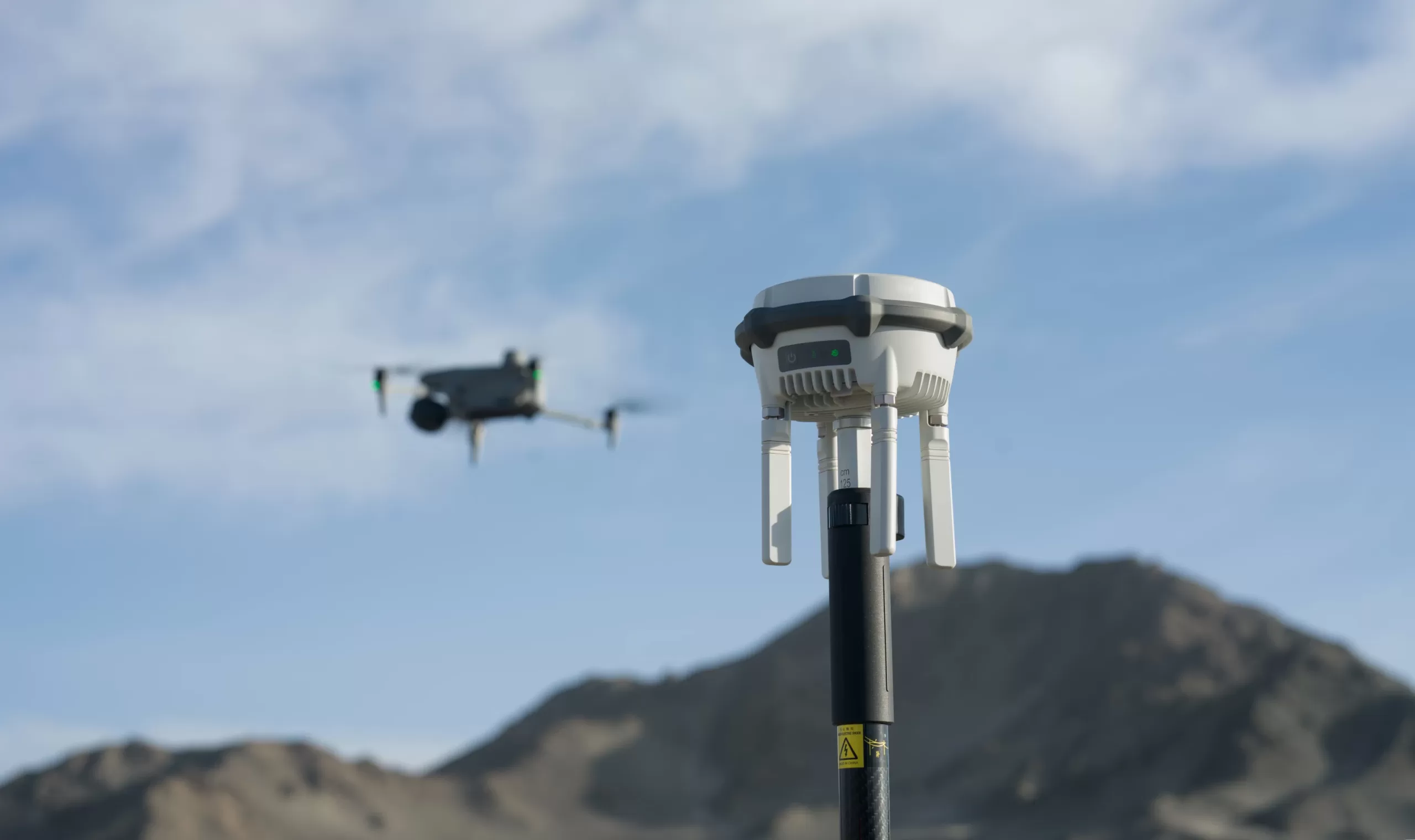
At Droneview.be, we provide professional drone services for the B2B market throughout Belgium. We transform aerial imagery into actionable data using cutting-edge technology, including the DJI Matrice 30T with RTK and the D-RTK 2 mobile station.
Our expertise lies in delivering centimeter-level precision for drone land surveys, orthomosaic mapping, and complex 3D data analysis. Whether it’s calculating stockpile volumes, conducting thermal inspections of solar farms, or providing weekly construction monitoring: we deliver the data you need to make faster, safer decisions.
Drone Service in Your Area
We operate nationwide with transparent travel costs from our base in Sint-Truiden. We frequently serve international clients in these key regions:
- Brussels & Tervuren: Drone mapping, real estate, and environmental monitoring (€33 – €40)
- Waterloo & Wavre: Infrastructure surveys and thermal inspections (€35 – €45)
- Antwerp & Ghent: Industrial inspections and port-related drone mapping (€54 – €72)
- Mons & Liège: Construction monitoring and large-scale terrain analysis (€48 – €74)
Travel costs outside these zones are calculated at €0.60/km. Request your free quote here.
Our Areas of Expertise
1. Periodic Construction Monitoring & Site Supervision
Optimize your project management with our weekly or monthly drone flights. We document the entire evolution of your site with RTK precision.
- Time-lapse: High-quality video evolution for marketing and stakeholders.
- Documentation: Visual evidence of every construction phase (from foundation to delivery).
- Baseline Surveys: Detailed pre-construction recording of the site and its surroundings.
Discover more about drone construction monitoring »
2. Drone Mapping & 3D Land Surveying
We transform aerial photos into accurate digital maps. Our Orthomosaic maps and 3D terrain models are delivered with centimeter-level accuracy thanks to our DJI RTK base station. Perfectly suited for integration into CAD or BIM software.
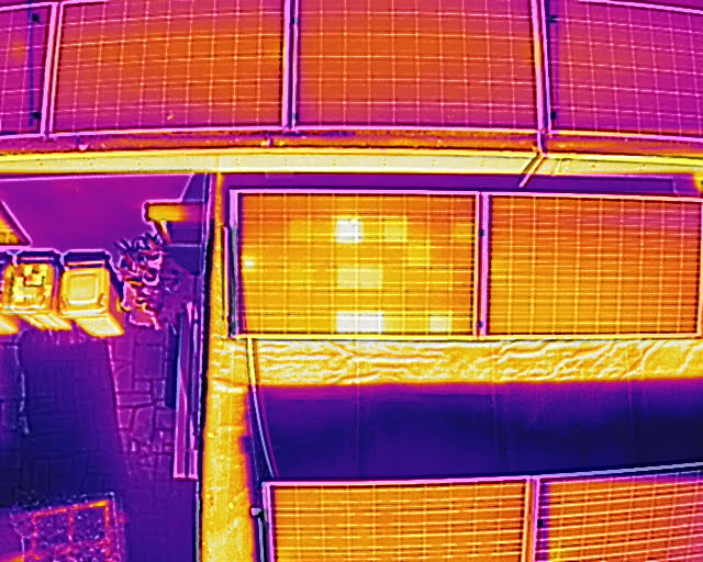
3. Thermal Inspection of Solar Panels
Prevent yield loss caused by defective cells or hotspots. Using the M30T’s thermal camera, we detect faulty diodes and string errors in compliance with insurance standards.
4. Technical Building Inspections (Roofs & Facades)
Inspect safely without scaffolding or cherry pickers. Thanks to the 200x zoom of the M30T, we can visualize the smallest cracks or corrosion on roofs, bridges, and wind turbines. Includes a detailed photographic report for damage assessment.
5. Heat Loss & Leak Detection
Identify thermal bridges and hidden water infiltration on flat roofs. Our thermal drones reveal energy losses that remain invisible to the naked eye.
6. Professional Drone Photography & Video
From high-end real estate promotion to corporate videos: we capture the perfect shot in 4K resolution.
7. Search & Rescue (S&R) Support
Utilizing thermal sensors and powerful zoom to locate heat sources or missing persons in support of official emergency services.
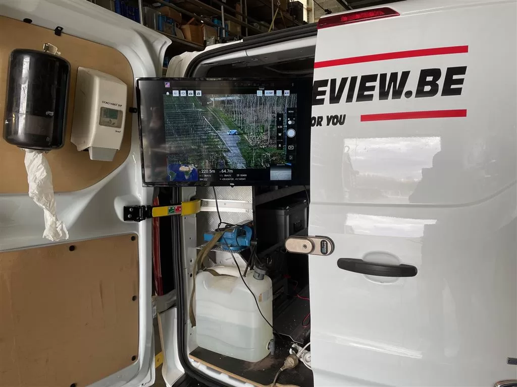
Live On-Site Monitoring
We offer a unique service where you can follow the flight live on an external 32” monitor. Make immediate decisions based on live footage and guide our pilot for specific detail shots.
Why Partner with DroneView.be?
- High-End Technology: DJI Matrice 30T with thermal camera and 200x zoom.
- Precision: RTK-corrected data for land surveying and volumetric analysis.
- Speed: Reports and 3D models often delivered within 24-48 hours.
- Certified: Professional pilots compliant with all EASA (EU) regulations.