
Introduction: The Power of Drone Mapping
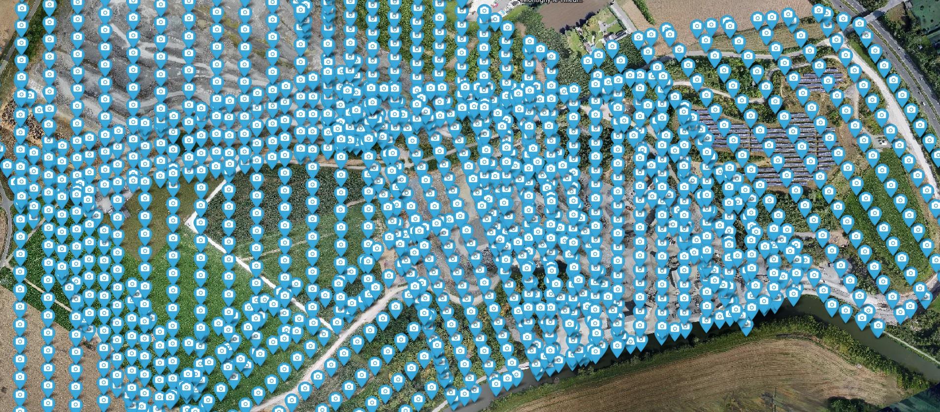
At DroneView.be, we do more than capture spectacular aerial photos. We transform drone imagery into measurable, actionable data for our clients. Traditional inspections and land surveys, especially across vast areas like quarries, are time-consuming, risky, and often inaccurate. Our recent project in a quarry perfectly illustrates how drone mapping streamlines this process. From 1,750 individual photos, we created an interactive 3D model, enabling the client to easily perform volume calculations and efficiently manage the site.
Case Study: Precision in the Quarry
The Project: Our client, a quarry operator, needed an accurate, up-to-date overview for material management and strategic planning. Covering more than 100 hectares, manual surveying was impossible. DroneView.be conducted a series of automated drone flights, resulting in a dataset of 1,750 images.
Our Approach: Mission Flights
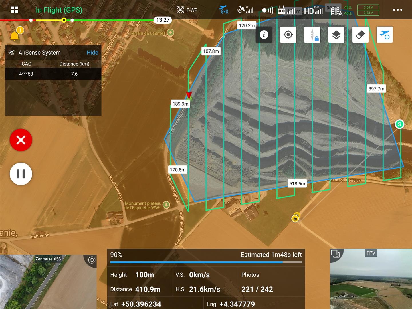
For a site of this size, preparation is crucial. We plan about ten mission flights, partly from the office and partly on-site. Each flight is carefully configured to systematically capture the entire area with proper overlap. The structured pattern ensures that all images can later be seamlessly processed into one complete 3D model in WebODM.
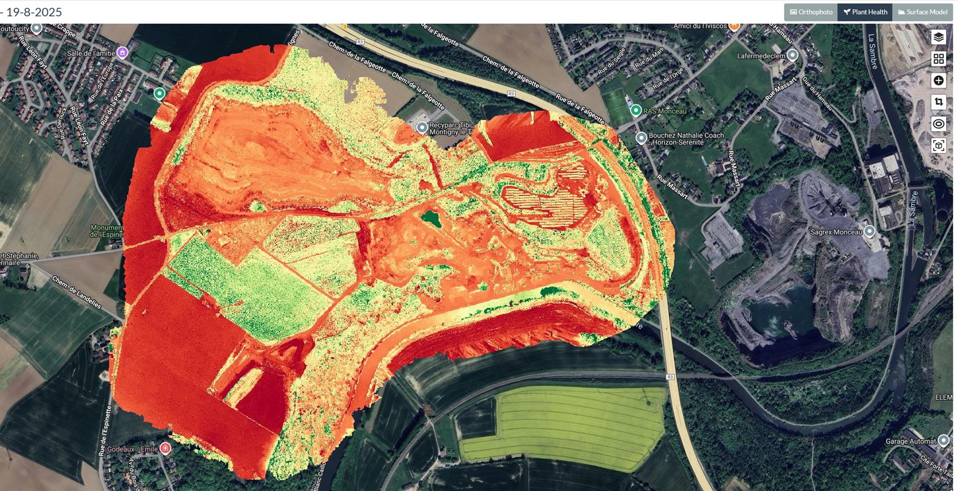
The Role of WebODM
The raw images are only the beginning. The real magic happens in processing. Using WebODM, a powerful open-source photogrammetry software, we generated several key products:
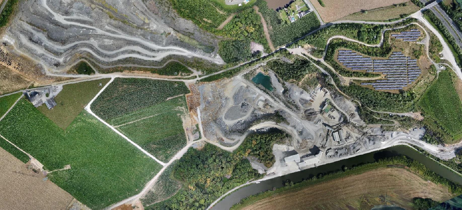
- Orthophoto: A corrected, scale-accurate aerial image, free from perspective distortion. Hundreds of photos are stitched into a seamless, high-resolution map.
- Digital Surface Model (DSM): Shows the height of all objects on-site, including stone piles, machinery, and buildings.
- Digital Terrain Model (DTM): Essential for volume calculations, displaying only the bare earth after removing objects digitally.

Concrete Results and Benefits
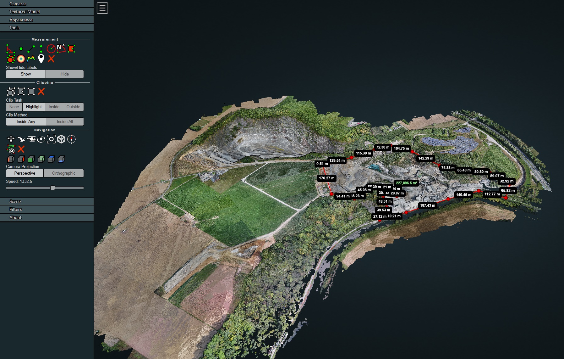
- Interactive 3D Model: Explore the quarry from any angle and height, perfect for investor presentations or detailed team planning.
- Accurate Volume Calculations: Combining DSM and DTM allows precise measurement of stone quantities, optimizing inventory management and reporting.
- Orthophotos: High-resolution maps offering a perfect overview, ideal for tracking changes over time or communicating site layout to subcontractors.
Full Web Version: No Software Needed!
All generated data – 3D model, orthophotos, terrain models – can be delivered as a web version. Clients can view and use results directly in a browser, making sharing with colleagues and partners effortless.
Interactive 3D Model in Action
To make the results even more tangible, we also created a video of the 3D model.
In the video below, you can see the quarry from all angles, as if you were flying around it yourself.
Thanks to this technology, clients get a clear and measurable overview of their site — ideal for presentations, planning, and project monitoring.
Beyond Quarries: Broader Applications
Drone mapping extends far beyond mining. Here are some other applications:
- Construction & Infrastructure: Accurate surveys, progress tracking, and earthwork volume calculations.
- Agriculture: Plant health monitoring via multispectral imagery, supporting precision farming.
- Heritage: Create digital twins of historical sites for restoration, monitoring, or education.
- Environment & Nature Management: Overview of large natural areas, erosion analysis, or mapping water flows.
Applications & Benefits for the Client
- Accurate Volume Calculations: Save time and avoid errors in material planning.
- Interactive 3D Models: Gain better insight into terrain and project progress.

- Orthophotos: Quickly overview large areas, ideal for reporting and team communication.
- Clear Reports: Easily shareable with colleagues and partners.
Broader Applications
The benefits of drone mapping go far beyond mining:
- Construction & Infrastructure: Earthworks and project planning.
- Agriculture: Accurate field measurements and land management.
- Heritage: Digital twin of historical sites.
- Environment & Nature Management: Overview of large areas and terrain changes.
Want to try WebODM yourself? Check out our previous article: Getting Started with WebODM.
Do you also want to learn how to make the most of the 2D and 3D viewer? Then read our new step-by-step tutorial.
This project is just one example of how we turn drone imagery into practical insights. Are you curious how DroneView.be can support your project? Contact us and discover the possibilities.